Image:White Sea Canal map.png
Un article de Wikipédia, l'encyclopédie libre.
Taille de cet aperçu : 699 × 600 pixels
Image en plus haute résolution (1 000 × 858 pixels, taille du fichier : 351 Kio, type MIME : image/png)
| | Ce fichier provient de Wikimedia Commons?. Les informations le concernant sont affichées ci-dessous (procédure). |
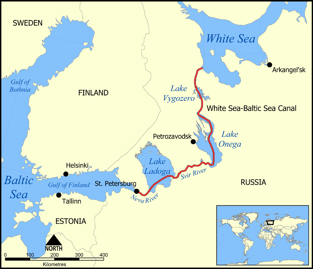
This map shows the route of the White Sea-Baltic Sea Canal ("Belomorkanal") between the White Sea and Baltic Sea. It shows the lakes Vygozero, Onega, and Ladoga, and the Sivr and Neva rivers too.
Created by NormanEinstein, December 6, 2005.

Historique du fichier
Cliquer sur une date et une heure pour voir le fichier tel qu’il était à ce moment-là
| Date et heure | Dimensions | Utilisateur | Commentaire | |
|---|---|---|---|---|
| actuel | 6 décembre 2005 à 19:59 | 1 000×858 (351 Kio) | NormanEinstein | (This map shows the route of the White Sea-Baltic Sea Canal between the White Sea and Baltic Sea. (Heh heh.) It shows the lakes Vygozero, Onega, and Ladoga, and the Sivr and Neva rivers too. Created by NormanEinstein, December 6, 2005. {{GFDL-self}} [[C) |
Pages contenant l’image
La page ci-dessous contient cette image :

