Image:Wfm orkney map.png
Un article de Wikipédia, l'encyclopédie libre.
Taille de cet aperçu : 515 × 600 pixels
Image en plus haute résolution (1 851 × 2 155 pixels, taille du fichier : 700 Kio, type MIME : image/png)
| | Ce fichier provient de Wikimedia Commons?. Les informations le concernant sont affichées ci-dessous (procédure). |
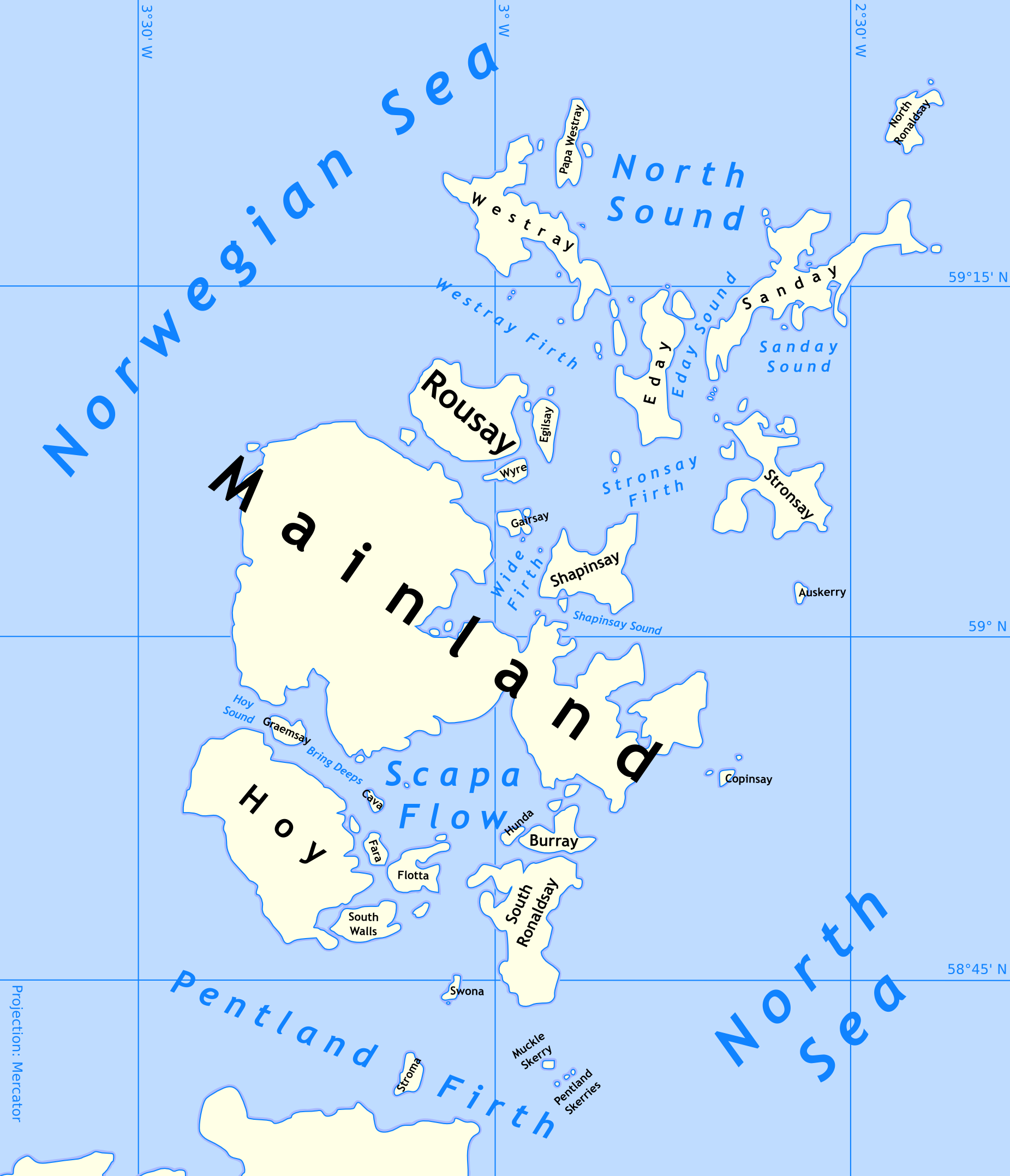
Outline map of the Orkney Islands in Scotland

Rendered using public-domain NOAA World Vector Shoreline (using panmap). The image was then processed and cleaned manually in photoshop, and then imported into Inkscape. In inkscape it was traced to a vector and the colours and labels were added.
[edit] TEST VERSION
- Please don't use this in articles yet - it's subject to radical changes
- Eventually I'll produce transport maps, any historical maps anyone asks me for, and smaller maps which show individual islands highlighted.
Historique du fichier
Cliquer sur une date et une heure pour voir le fichier tel qu’il était à ce moment-là
| Date et heure | Dimensions | Utilisateur | Commentaire | |
|---|---|---|---|---|
| actuel | 24 août 2005 à 19:39 | 1 851×2 155 (700 Kio) | Finlay McWalter | (Outline map of the Orkney Islands in Scotland {{GFDL}} Rendered using public-domain NOAA World Vector Shoreline (using panmap). The image was then processed and cleaned manually in photoshop, and then imported into Inkscape. In inkscape it was traced ) |
Pages contenant l’image
La page ci-dessous contient cette image :

