Image:Wfm islay landsat.jpg
Un article de Wikipédia, l'encyclopédie libre.
Taille de cet aperçu : 800 × 593 pixels
Image en plus haute résolution (1 280 × 948 pixels, taille du fichier : 285 Kio, type MIME : image/jpeg)
| | Ce fichier provient de Wikimedia Commons?. Les informations le concernant sont affichées ci-dessous (procédure). |
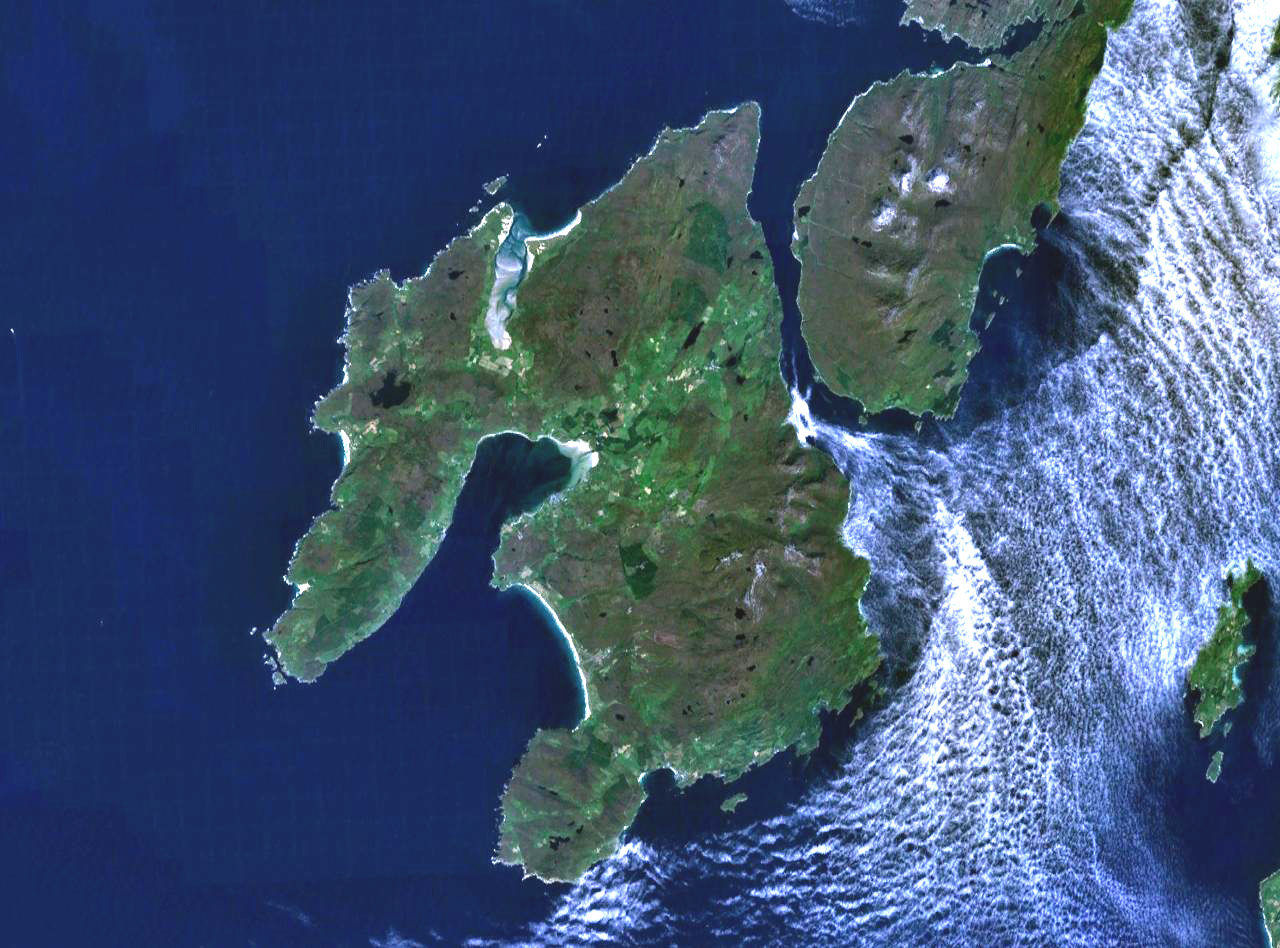
The island of Islay off the west coast of Scotland. The south part of the neighbouring island if Jura is visible to the northeast, and on the far east (right) of frame is the small island of Gigha.
Landsat 7 image, collected using NASA World Wind.
| This image is in the public domain because it is a screenshot from NASA’s globe software World Wind using Blue Marble, Landsat or USGS layer, all of which are in public domain. |
|
Historique du fichier
Cliquer sur une date et une heure pour voir le fichier tel qu’il était à ce moment-là
| Date et heure | Dimensions | Utilisateur | Commentaire | |
|---|---|---|---|---|
| actuel | 4 août 2005 à 21:28 | 1 280×948 (285 Kio) | Finlay McWalter | (The island of Islay off the west coast of Scotland. Landsat 7 image, collected using NASA World Wind. {{PD-USGov-NASA}} category:islands) |
Pages contenant l’image
La page ci-dessous contient cette image :
Métadonnées
Ce fichier contient des informations supplémentaires probablement ajoutées par l’appareil photo numérique ou le numériseur qui l’a acquis. Si le fichier a été modifié depuis son état original, certains détails peuvent ne pas refléter entièrement l’image modifiée.
| Orientation | Normale |
|---|---|
| Résolution horizontale | 72 dpi |
| Résolution verticale | 72 dpi |
| Logiciel utilisé | Adobe Photoshop 7.0 |
| Date de modification | 4 août 2005 à 14:06 |
| Espace colorimétrique | 65535 |

