Image:Wellington landsat labelled.jpg
Un article de Wikipédia, l'encyclopédie libre.
Taille de cet aperçu : 800 × 593 pixels
Image en plus haute résolution (1 280 × 948 pixels, taille du fichier : 206 Kio, type MIME : image/jpeg)
| | Ce fichier provient de Wikimedia Commons?. Les informations le concernant sont affichées ci-dessous (procédure). |
| Description |
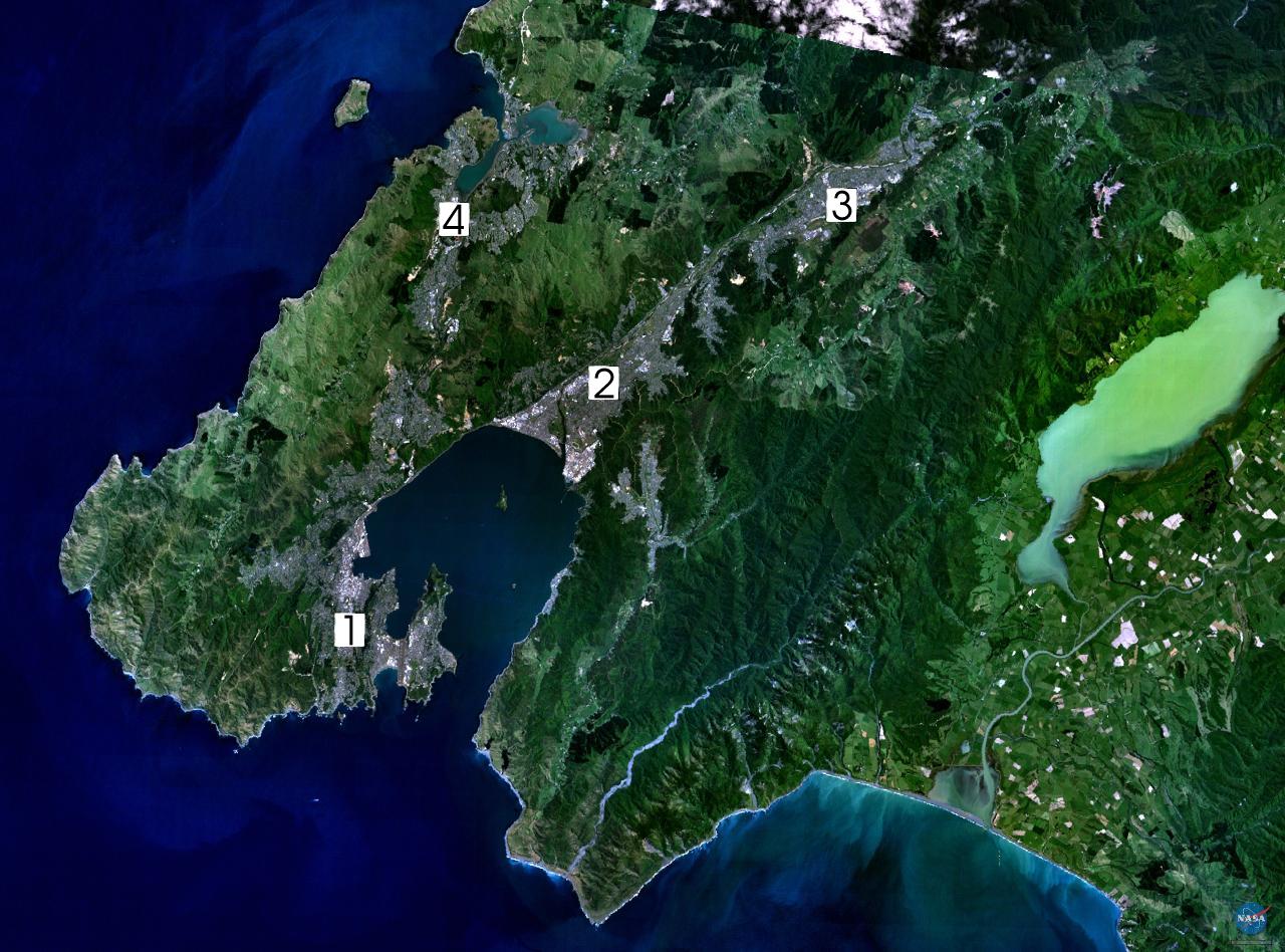
NASA World Wind composite landsat-7 satellite image of Wellington, New Zealand. (1) Central Wellington (2) Lower Hutt (3) Upper Hutt (4) Porirua. English: Satellite photo of the Wellington conurbation: (1) Wellington; (2) Lower Hutt; (3) Upper Hutt; (4) Porirua.
日本語: 人工衛星によるウェリントンの写真。1: ウェリントン、2: ロウワー・ハット (Lower Hutt)、3: アッパー・ハット (Upper Hutt)、4: ポリルア (Porirua)。以上の4市がウェリントン都市圏 (urban area) を構成する
Norsk (bokmål): Satelittfoto av Wellingtonregionen. (1) Wellington (2) Lower Hutt (3) Upper Hutt (4) Porirua
|
|||
|---|---|---|---|---|
| Source |
en:wikipedia |
|||
| Date | ||||
| Author |
NASA, edited by en:User:Clawed |
|||
| Permission (Reusing this image) |
|
Historique du fichier
Cliquer sur une date et une heure pour voir le fichier tel qu’il était à ce moment-là
| Date et heure | Dimensions | Utilisateur | Commentaire | |
|---|---|---|---|---|
| actuel | 1 septembre 2005 à 18:34 | 1 280×948 (206 Kio) | Klipp | (NASA World Wind composite landsat-7 satellite image of Wellington, New Zealand. (1) Central Wellington (2) Lower Hutt (3) Upper Hutt (4) Porirua. {{PD-USGov-NASA}} ) |
Pages contenant l’image
La page ci-dessous contient cette image :

