Image:Waterways New York City Map Julius Schorzman.png
Un article de Wikipédia, l'encyclopédie libre.
Taille de cet aperçu : 616 × 600 pixels
Image en plus haute résolution (2 652 × 2 582 pixels, taille du fichier : 6,19 Mio, type MIME : image/png)
| | Ce fichier provient de Wikimedia Commons?. Les informations le concernant sont affichées ci-dessous (procédure). |
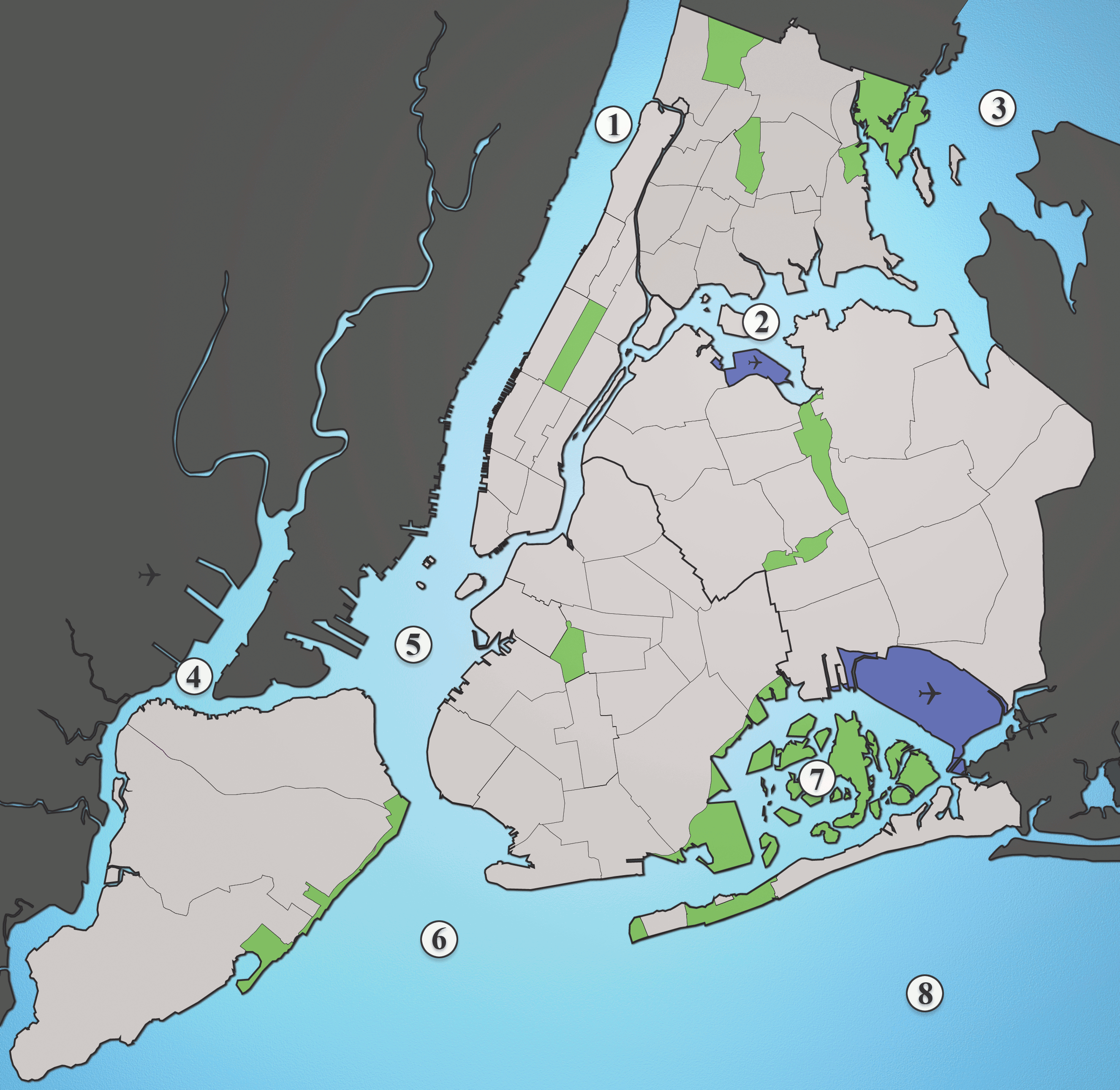
A map showing the major waterways in New York City.
- Hudson River
- East River
- Long Island Sound
- Newark Bay
- Upper New York Bay
- Lower New York Bay
- Jamaica Bay
- Atlantic Ocean
Source: I created this image myself using various maps and images as source material.
| This file is licensed under the Creative Commons Attribution ShareAlike 2.5 License. In short: you are free to share and make derivative works of the file under the conditions that you appropriately attribute it, and that you distribute it only under a license identical to this one. Official license |
Historique du fichier
Cliquer sur une date et une heure pour voir le fichier tel qu’il était à ce moment-là
| Date et heure | Dimensions | Utilisateur | Commentaire | |
|---|---|---|---|---|
| actuel | 19 août 2005 à 04:36 | 2 652×2 582 (6,19 Mio) | Quasipalm | (A map showing the major waterways in New York City. 1) Hudson River 2) East River 3) Long Island Sound 4) Newark Bay 5) Upper New York Bay 6) Lower New York Bay 7) Jamaica Bay 8) Atlantic Ocean Source: I created this image using various maps and images.) |
Pages contenant l’image
Les pages ci-dessous contiennent cette image :

