Image:Viae Cassia Aurelia Clodia.jpg
Un article de Wikipédia, l'encyclopédie libre.
Taille de cet aperçu : 462 × 600 pixels
Image en plus haute résolution (945 × 1 227 pixels, taille du fichier : 374 Kio, type MIME : image/jpeg)
| | Ce fichier provient de Wikimedia Commons?. Les informations le concernant sont affichées ci-dessous (procédure). |
| Description |
|
|---|---|
| Source | |
| Date |
31 Aug 2007 |
| Author | |
| Permission (Reusing this image) |
|

Based on a map from "Historical Atlas" by William R. Shepherd, New York, Henry Holt and Company, 1923 now in Public Domain. Courtesy of the University of Texas Libraries, The University of Texas at Austin. [1]
Historique du fichier
Cliquer sur une date et une heure pour voir le fichier tel qu’il était à ce moment-là
| Date et heure | Dimensions | Utilisateur | Commentaire | |
|---|---|---|---|---|
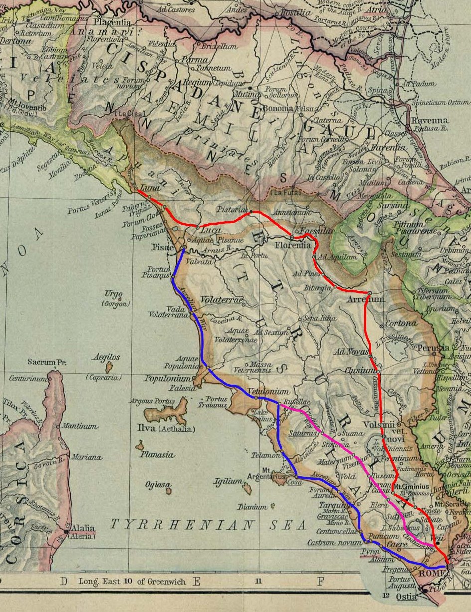
| actuel | 31 août 2007 à 23:31 | 945×1 227 (374 Kio) | Eh101 | ({{Information |Description={{it|il sistema viario dell'antica Roma lungo la direttrice Nord-Ovest. In blu il primo tratto originale della via Aurelia, in rosso la via Cassia, in viola la via Clodia.}} {{en|Ancient roman way system leading toward North-Wes) |
Pages contenant l’image
La page ci-dessous contient cette image :


![[1]](http://www.lib.utexas.edu/maps/historical/shepherd/italy_ancient_north.jpg)