Image:Typh longwang sept28.jpg
Un article de Wikipédia, l'encyclopédie libre.
Taille de cet aperçu : 600 × 600 pixels
Image en plus haute résolution (7 800 × 7 800 pixels, taille du fichier : 9,49 Mio, type MIME : image/jpeg)
| | Ce fichier provient de Wikimedia Commons?. Les informations le concernant sont affichées ci-dessous (procédure). |
[edit] Summary
| Description |
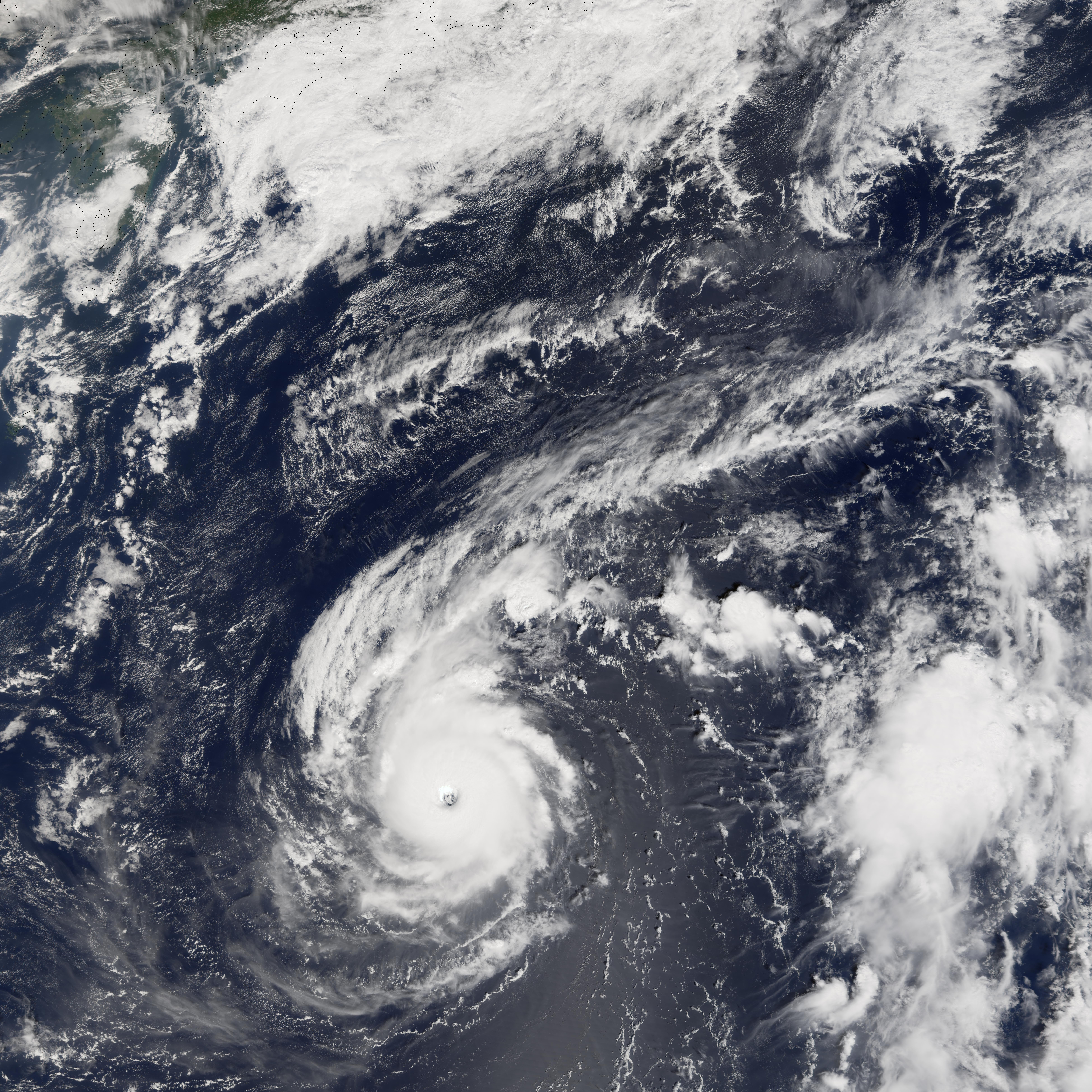
Typhoon Longwang was a small but well-organized and powerful storm system when the Moderate Resolution Imaging Spectroradiometer (MODIS) on NASA’s Terra satellite captured this image at 10:30 a.m. local time, on September 28, 2005. At the time of this MODIS observation, Longwang was 900 kilometers (590 miles) from Okinawa and a comparable distance south of Honshu (the main island in the Japanese chain at the top of this image). It was travelling roughly westward towards the Chinese coast on a track that would take it through the southern fringe of the Japanese islands. Typhoon Longwang had sustained winds of 200 kilometers per hour (125 miles per hour) near the storm’s center, and it was projected to continue to strengthen slightly in the following days. |
|||||
|---|---|---|---|---|---|---|
| Source |
http://earthobservatory.nasa.gov/NaturalHazards/natural_hazards_v2.php3?img_id=13169 |
|||||
| Date |
2005-09-28 |
|||||
| Author |
NASA image created by Jesse Allen, Earth Observatory, using data courtesy of the MODIS Rapid Response team. |
|||||
| Permission (Reusing this image) |
|

Historique du fichier
Cliquer sur une date et une heure pour voir le fichier tel qu’il était à ce moment-là
| Date et heure | Dimensions | Utilisateur | Commentaire | |
|---|---|---|---|---|
| actuel | 7 septembre 2006 à 01:11 | 7 800×7 800 (9,49 Mio) | Good kitty | (== Summary == {{Information |Description=Typhoon Longwang was a small but well-organized and powerful storm system when the Moderate Resolution Imaging Spectroradiometer (MODIS) on NASA’s Terra satellite captured this image at 10:30 a.m. local time, on ) |
Pages contenant l’image
La page ci-dessous contient cette image :

