Image:Trinity Watershed.png
Un article de Wikipédia, l'encyclopédie libre.
Taille de cet aperçu : 659 × 600 pixels
Image en plus haute résolution (811 × 738 pixels, taille du fichier : 246 Kio, type MIME : image/png)
| | Ce fichier provient de Wikimedia Commons?. Les informations le concernant sont affichées ci-dessous (procédure). |
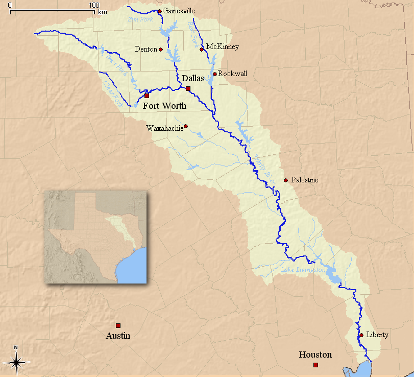
This is a map of the Trinity River watershed in Texas. I, Kuru, created from data originating at the USGS.
|
Historique du fichier
Cliquer sur une date et une heure pour voir le fichier tel qu’il était à ce moment-là
| Date et heure | Dimensions | Utilisateur | Commentaire | |
|---|---|---|---|---|
| actuel | 25 juin 2006 à 05:50 | 811×738 (246 Kio) | Kuru | (This is a map of the Trinity River watershed in Texas. I, Kuru, created from data originating at the USGS. {{self|cc-by-sa-2.5}} ) |
Pages contenant l’image
La page ci-dessous contient cette image :

