Image:Scandinavia-12th century.png
Un article de Wikipédia, l'encyclopédie libre.
Taille de cet aperçu : 507 × 599 pixels
Image en plus haute résolution (1 650 × 1 950 pixels, taille du fichier : 340 Kio, type MIME : image/png)
| | Ce fichier provient de Wikimedia Commons?. Les informations le concernant sont affichées ci-dessous (procédure). |
[edit] Summary
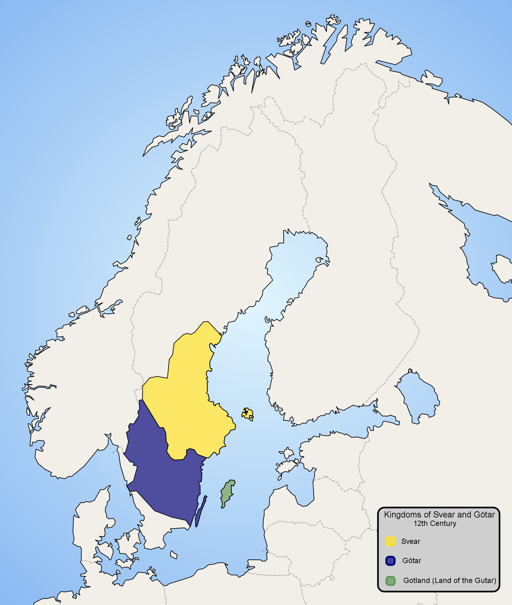
Map of Scandinavia in 12th century, showing modern borders in grey. Made by Ningyou.
Åboland connecting Åland to mainland Finland is missing from the base map and is thus colourd blue as the sea.
[edit] Licensing
| I, the copyright holder of this work, hereby release it into the public domain. This applies worldwide. In case this is not legally possible: Afrikaans | Alemannisch | Aragonés | العربية | Asturianu | Български | Català | Česky | Cymraeg | Dansk | Deutsch | Eʋegbe | Ελληνικά | English | Español | Esperanto | Euskara | Estremeñu | فارسی | Français | Galego | 한국어 | हिन्दी | Hrvatski | Ido | Bahasa Indonesia | Íslenska | Italiano | עברית | Kurdî / كوردی | Latina | Lietuvių | Latviešu | Magyar | Македонски | Bahasa Melayu | Nederlands | Norsk (bokmål) | Norsk (nynorsk) | 日本語 | Polski | Português | Ripoarisch | Română | Русский | Shqip | Slovenčina | Slovenščina | Српски / Srpski | Svenska | ไทย | Tagalog | Türkçe | Українська | Tiếng Việt | Walon | 中文(简体) | 中文(繁體) | zh-yue-hant | +/- |
 |
This map image should be recreated using vector graphics as an SVG file. This has several advantages; see Commons:Media for cleanup for more information. If an SVG form of this image is already available, please upload it. After uploading an SVG, replace this template with template {{Vector version available|new image name.svg}} in this image. |
|
العربية | Български | Català | Česky | Dansk | Deutsch | English | Esperanto | Español | Français | 한국어 | Italiano | Magyar | Lietuvių | Nederlands | 日本語 | Polski | Português | Română | Русский | Suomi | Svenska | Türkçe | Українська | Tiếng Việt | मराठी | 中文(繁體) | 中文(简体) | +/- |
|
Historique du fichier
Cliquer sur une date et une heure pour voir le fichier tel qu’il était à ce moment-là
| Date et heure | Dimensions | Utilisateur | Commentaire | |
|---|---|---|---|---|
| actuel | 21 février 2007 à 21:19 | 1 650×1 950 (340 Kio) | Tene | (Optimised (0) [Only tried 5 and 0]) |
| 13 janvier 2006 à 23:57 | 1 650×1 950 (479 Kio) | Ningyou | (Map of Scandinavia in 12th century, showing modern borders in grey. Made by fi:Käyttäjä:Ningyou. Category:Maps of Sweden Category:Maps of Scandinavia) |
Pages contenant l’image
La page ci-dessous contient cette image :

