Image:Ruhr area-map.png
Un article de Wikipédia, l'encyclopédie libre.
Taille de cet aperçu : 800 × 474 pixels
Image en plus haute résolution (1 000 × 593 pixels, taille du fichier : 115 Kio, type MIME : image/png)
| | Ce fichier provient de Wikimedia Commons?. Les informations le concernant sont affichées ci-dessous (procédure). |
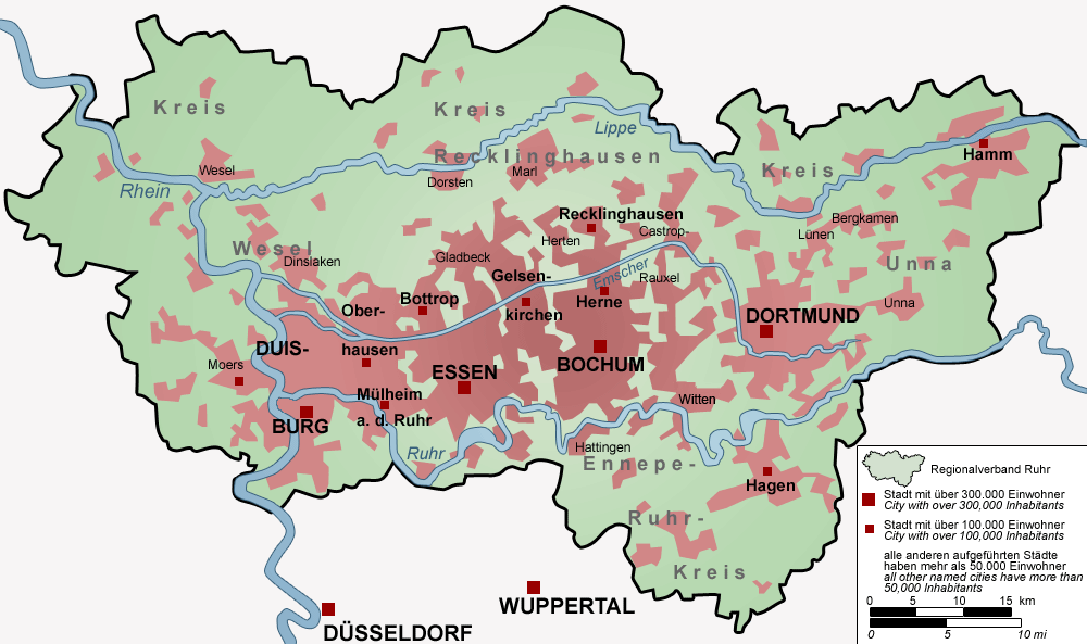
Map of the Ruhr Area, Germany
- The map shows the Ruhr Area, Germany with all cities over 50,000 Inhabitants
- "drawn" by myself, Threedots (Daniel Ullrich) with Adobe Photoshop 6.0 on 10th of December 2004
- Database: official GeoData (in german) and several maps
Karte des Ruhrgebiets, Deutschland
- Die Karte zeigt das Ruhrgebiet, Deutschland mit allen Städten über 50.000 Einwohnern
- von mir selbst, Threedots (Daniel Ullrich), am 10. Dezember 2004 mit Adobe Photoshop 6.0 "gezeichnet"
- Datengrundlage: GeoDaten des Landesvermessungsamt NRW und verschiedene andere Karten

Historique du fichier
Cliquer sur une date et une heure pour voir le fichier tel qu’il était à ce moment-là
| Date et heure | Dimensions | Utilisateur | Commentaire | |
|---|---|---|---|---|
| actuel | 4 janvier 2006 à 12:46 | 1 000×593 (115 Kio) | Piedone | (correction of situation of Duisburg and Moers) |
| 21 décembre 2004 à 01:20 | 1 000×593 (95 Kio) | Threedots | (small changes (colors, wiriting, yardstick etc)) | |
| 10 décembre 2004 à 13:37 | 1 000×593 (94 Kio) | Threedots | (Map of the Ruhr Area) | |
| 10 décembre 2004 à 06:48 | 1 000×593 (92 Kio) | Threedots | (Map of the Ruhr Area, Germany) |
Pages contenant l’image
Les pages ci-dessous contiennent cette image :

