Image:Pre-roman iron age (map).PNG
Un article de Wikipédia, l'encyclopédie libre.
Taille de cet aperçu : 577 × 600 pixels
Image en plus haute résolution (657 × 683 pixels, taille du fichier : 32 Kio, type MIME : image/png)
| | Ce fichier provient de Wikimedia Commons?. Les informations le concernant sont affichées ci-dessous (procédure). |
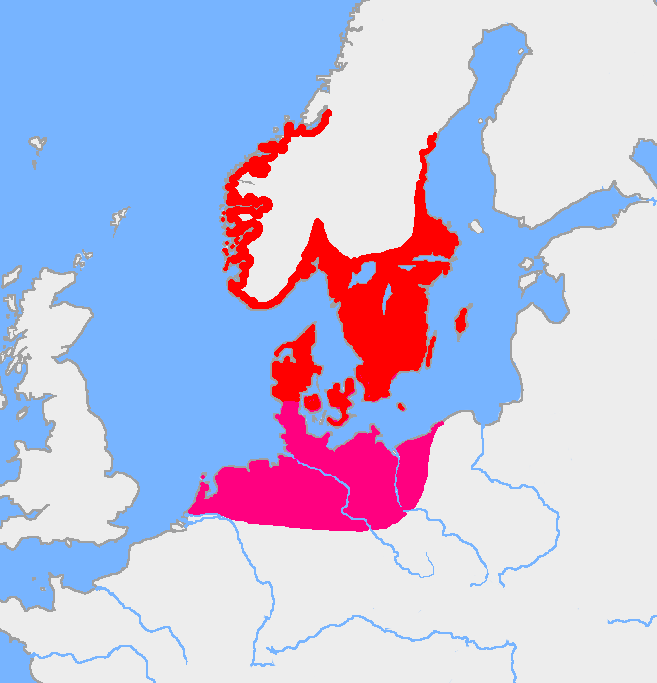
Map of the Nordic Iron Age and the Jastorf culture. The map based on Image:Europe plain rivers.png and the Harper Atlas of World History (ed. Vidal-Naquet) in Swedish translation: Atlas över mänsklighetens historia.
(copied from en:, uploaded by en:User:Wiglaf as PD on 15 April 2005)
| This image has been released into the public domain by its author, Wiglaf. This applies worldwide. In some countries this may not be legally possible; if so: العربية | Български | Deutsch | Ελληνικά | English | Español | Français | Italiano | 日本語 | 한국어 | Polski | Русский | Српски / Srpski | Svenska | தமிழ் | Українська | 中文(繁體) | 中文(简体) +/- |
Historique du fichier
Cliquer sur une date et une heure pour voir le fichier tel qu’il était à ce moment-là
| Date et heure | Dimensions | Utilisateur | Commentaire | |
|---|---|---|---|---|
| actuel | 15 août 2005 à 09:26 | 657×683 (32 Kio) | Square87 | (from en.wiki {{PD}}) |
Pages contenant l’image
Les pages ci-dessous contiennent cette image :

