Image:PIA04301.jpg
Un article de Wikipédia, l'encyclopédie libre.

Taille de cet aperçu : 800 × 572 pixels
Image en plus haute résolution (3 685 × 2 635 pixels, taille du fichier : 2,6 Mio, type MIME : image/jpeg)
| | Ce fichier provient de Wikimedia Commons?. Les informations le concernant sont affichées ci-dessous (procédure). |
[edit] Summary
| Description |
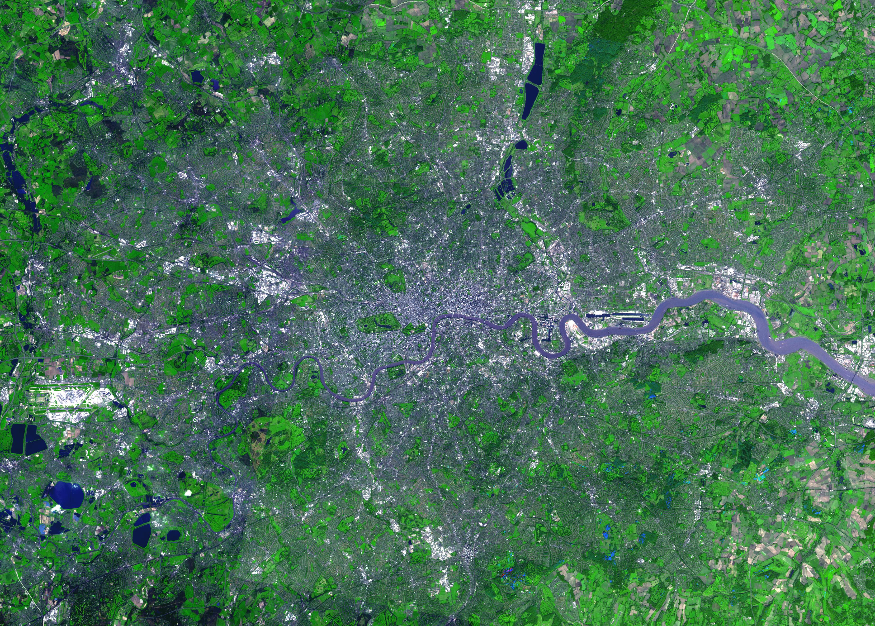
Deutsch:
Satellitenbild von London, England aus der Vogelperspektive.
English:
Satellite view of London, bird's-eye view.
Français :
Vue satellite de Londres, perspective. |
|||||
|---|---|---|---|---|---|---|
| Source | ||||||
| Date | ||||||
| Author | ||||||
| Permission (Reusing this image) |
|

Original Caption Released with Image:
This image was acquired on October 12, 2001 by the Advanced Spaceborne Thermal Emission and Reflection Radiometer (ASTER) on NASA's Terra satellite. With its 14 spectral bands from the visible to the thermal infrared wavelength region, and its high spatial resolution of 15 to 90 meters (about 50 to 300 feet), ASTER images Earth to map and monitor the changing surface of our planet.
Size: 39.5 x 55.3 km (24.5 x 34.3 miles)
Location: 51.5 deg. North lat., 0.1 deg. West long.
Orientation: North at top
Image Data: ASTER bands 1,2, and 3.
Original Data Resolution: 15 m
Date Acquired: October 12, 2001
Image Credit: NASA/GSFC/METI/ERSDAC/JAROS, and U.S./Japan ASTER Science Team
Historique du fichier
Cliquer sur une date et une heure pour voir le fichier tel qu’il était à ce moment-là
| Date et heure | Dimensions | Utilisateur | Commentaire | |
|---|---|---|---|---|
| actuel | 24 février 2007 à 18:29 | 3 685×2 635 (2,6 Mio) | Steff | (From the German-speaking Wikipedia. Satellitenbild von London, England aus der Vogelperspektive. *Quelle: .jpl.nasa.gov/catalog/PIA04301 *Lizenz: PD *Beschreibung: PIA04301: London, England ''Original Caption Released with Image:'' ''This image was ) |
Pages contenant l’image
Les pages ci-dessous contiennent cette image :

