Image:Ocean gravity map.gif
Un article de Wikipédia, l'encyclopédie libre.
Taille de cet aperçu : 800 × 473 pixels
Image en plus haute résolution (1 010 × 597 pixels, taille du fichier : 466 Kio, type MIME : image/gif)
| | Ce fichier provient de Wikimedia Commons?. Les informations le concernant sont affichées ci-dessous (procédure). |
| Description |
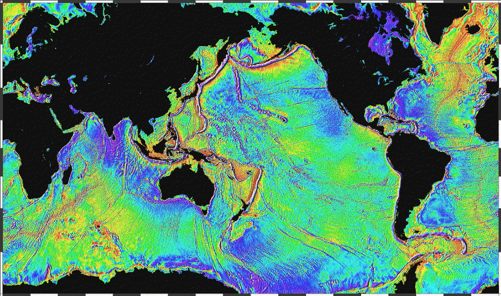
English: Ocean basins mapped with satellite altimetry. Seafloor features larger than 10 km are detected by resulting gravitational distortion of sea surface.
|
|---|---|
| Source |
http://www.ngdc.noaa.gov/mgg/bathymetry/predicted/explore.HTML |
| Date |
2005 |
| Author |
NOAA |
| Permission (Reusing this image) |
see below |
| This image is in the public domain because it contains materials that originally came from the U.S. National Oceanic and Atmospheric Administration, taken or made during the course of an employee's official duties. |
|
Historique du fichier
Cliquer sur une date et une heure pour voir le fichier tel qu’il était à ce moment-là
| Date et heure | Dimensions | Utilisateur | Commentaire | |
|---|---|---|---|---|
| actuel | 4 avril 2006 à 00:18 | 1 010×597 (466 Kio) | Korrigan | (Ocean basins mapped with satellite altimetry. Seafloor features larger than 10 km are detected by resulting gravitational distortion of sea surface. Source: http://www.ngdc.noaa.gov/mgg/bathymetry/predicted/explore.HTML {{PD-USGov-DOC-NOAA}} [[Cate) |
| 19 mars 2006 à 22:36 | 1 010×597 (196 Kio) | Maksim | (La bildo estas kopiita de wikipedia:en. La originala priskribo estas: Ocean basins mapped with satellite altimetry. Seafloor features larger than 10 km are detected by resulting gravitational distortion of sea surface. Source: http://www.ngdc.noaa.go) |
Pages contenant l’image
Les pages ci-dessous contiennent cette image :

