Image:Northern Limestone Alps.png
Un article de Wikipédia, l'encyclopédie libre.
Taille de cet aperçu : 800 × 428 pixels
Image en plus haute résolution (1 321 × 707 pixels, taille du fichier : 68 Kio, type MIME : image/png)
| | Ce fichier provient de Wikimedia Commons?. Les informations le concernant sont affichées ci-dessous (procédure). |
[edit] Beschrijving
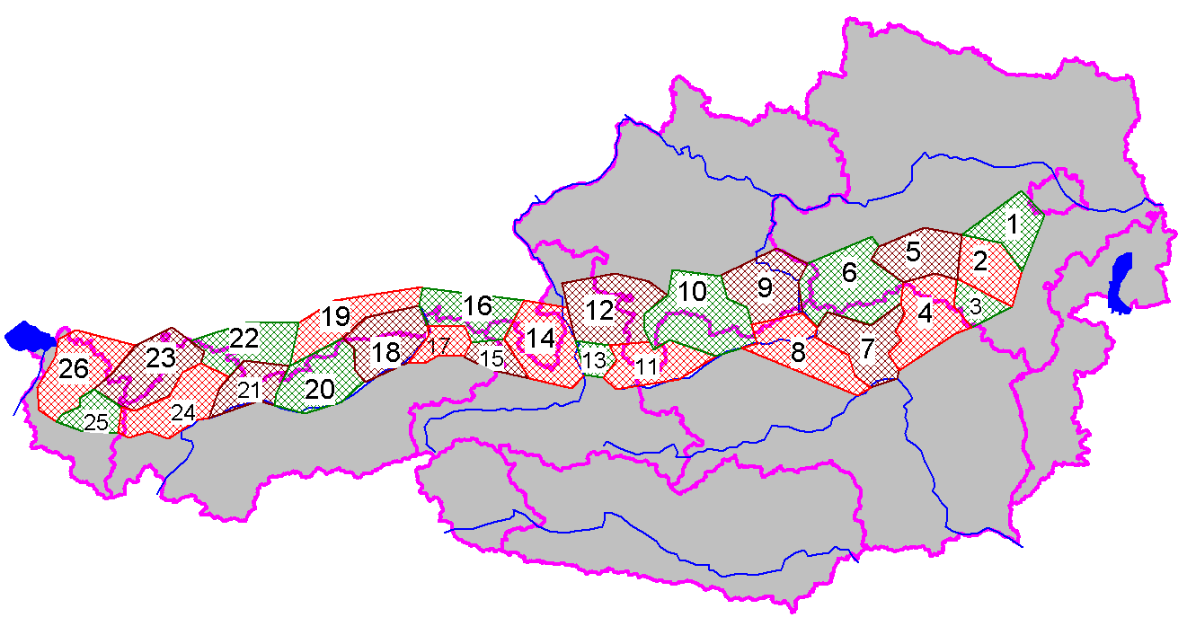
Map with the groups of the Northern Limestone Alps (purple lines showing international borders and the borders of Austrian states)
[edit] Licensing
 |
Permission is granted to copy, distribute and/or modify this document under the terms of the GNU Free Documentation License, Version 1.2 or any later version published by the Free Software Foundation; with no Invariant Sections, no Front-Cover Texts, and no Back-Cover Texts. Subject to disclaimers. Asturianu | Български | Català | Deutsch | English | Español | Français | Gaeilge | Italiano | 한국어 | 日本語 | Polski | Português | Română | Türkçe | +/- |
Historique du fichier
Cliquer sur une date et une heure pour voir le fichier tel qu’il était à ce moment-là
| Date et heure | Dimensions | Utilisateur | Commentaire | |
|---|---|---|---|---|
| actuel | 22 septembre 2005 à 11:40 | 1 321×707 (68 Kio) | Tubantia | (Map with the groups of the Northern Limestone Alps (purple lines showing international borders and the borders of Austrian states) Category:Alps) |
Pages contenant l’image
Les pages ci-dessous contiennent cette image :

