Image:Nanda-sanctuary-annotated.jpg
Un article de Wikipédia, l'encyclopédie libre.
Taille de cet aperçu : 466 × 599 pixels
Image en plus haute résolution (535 × 688 pixels, taille du fichier : 307 Kio, type MIME : image/jpeg)
| | Ce fichier provient de Wikimedia Commons?. Les informations le concernant sont affichées ci-dessous (procédure). |
[edit] Summary
| Description |
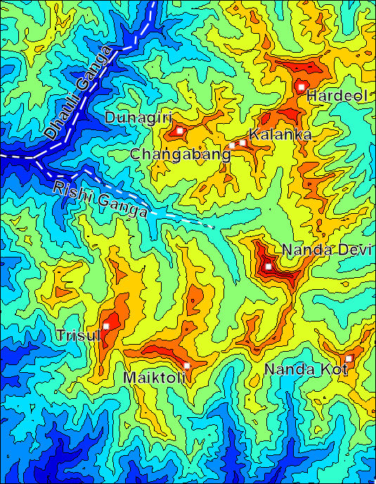
Color contour map of the Nanda Devi Sanctuary. Made using MATLAB from public SRTM data. Contour interval 500 metres, from 2000 m to 7500 m. Boundaries are Latitudes 30.65 N, 30.15 N; longitudes 79.65 E, 80.1 E. |
|---|---|
| Source |
self-made |
| Date |
May 4, 2007 |
| Author | |
| Permission (Reusing this image) |
see below |
[edit] Licensing
|
Historique du fichier
Cliquer sur une date et une heure pour voir le fichier tel qu’il était à ce moment-là
| Date et heure | Dimensions | Utilisateur | Commentaire | |
|---|---|---|---|---|
| actuel | 4 mai 2007 à 20:35 | 535×688 (307 Kio) | Spireguy | ({{Information |Description=Color contour map of the Nanda Devi Sanctuary. Made using MATLAB from public SRTM data. Contour interval 500 metres, from 2000 m to 7500 m. |Source=self-made |Date=May 4, 2007 |Author= User:Spireguy }} ) |
Pages contenant l’image
La page ci-dessous contient cette image :

