Image:Missolonghi siege general map-fr.jpg
Un article de Wikipédia, l'encyclopédie libre.
Taille de cet aperçu : 500 × 600 pixels
Image en plus haute résolution (1 400 × 1 680 pixels, taille du fichier : 632 Kio, type MIME : image/jpeg)
| | Ce fichier provient de Wikimedia Commons?. Les informations le concernant sont affichées ci-dessous (procédure). |
[edit] Summary
| Description |
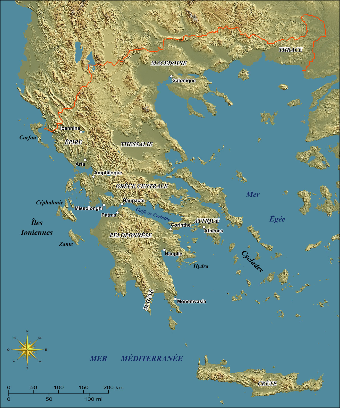
General map of Greece to illustrate the Siege of Missolonghi in the 1820's during the Greek War of Independence. |
|---|---|
| Source |
Own work ; |
| Date |
February 2007 |
| Author |
Eric Gaba (Sting) |
| Permission (Reusing this image) |
GFDL + CC-BY-SA |
- Sujet : Carte générale de la Grèce destinée à illustrer l'épisode du siège de Missolonghi dans les années 1820 durant la guerre d'indépendance grecque ;
- Source : Réalisation personnelle ;
-
- Fond de carte : NASA Shuttle Radar Topography Mission (SRTM3 v.2) (domaine public) édité avec 3DEM de Visualization Software LLC créé par Richard Horne (perspectives corrigées) (éclairage : 45° N-E ; azimut 50°) ;
- Référence utilisée pour le tracé des lacs en Béotie tels que durant le XIXe siècle : Gasp. G. Mistardis, Recherches (hydrogéologiques) dans la région des lacs karstiques béotiens (École des Mines de Paris) ;
- Rose des vents : Image:Brújula.svg (modifiée) créée par Serg!o sous GFDL ;
- Auteur : Eric Gaba (fr:Sting) ;
- Date : Février 2007 ;
[edit] Licensing

Historique du fichier
Cliquer sur une date et une heure pour voir le fichier tel qu’il était à ce moment-là
| Date et heure | Dimensions | Utilisateur | Commentaire | |
|---|---|---|---|---|
| actuel | 27 février 2007 à 04:30 | 1 400×1 680 (632 Kio) | Sting | ({{Information| |Description=General map of Greece to illustrate the Siege of Missolonghi in the 1820's during the Greek War of Independence. |Source= Own work ;<br/>Background map : [http://ww) |
Pages contenant l’image
La page ci-dessous contient cette image :
Métadonnées
Ce fichier contient des informations supplémentaires probablement ajoutées par l’appareil photo numérique ou le numériseur qui l’a acquis. Si le fichier a été modifié depuis son état original, certains détails peuvent ne pas refléter entièrement l’image modifiée.
| Orientation | Normale |
|---|---|
| Résolution horizontale | 72 dpi |
| Résolution verticale | 72 dpi |
| Logiciel utilisé | Adobe Photoshop 7.0 |
| Date de modification | 26 février 2007 à 23:22 |
| Espace colorimétrique | 65535 |

