Image:MerguiArchipelagoMap.png
Un article de Wikipédia, l'encyclopédie libre.
Taille de cet aperçu : 322 × 598 pixels
Image en plus haute résolution (973 × 1 808 pixels, taille du fichier : 61 Kio, type MIME : image/png)
| | Ce fichier provient de Wikimedia Commons?. Les informations le concernant sont affichées ci-dessous (procédure). |
| Description |
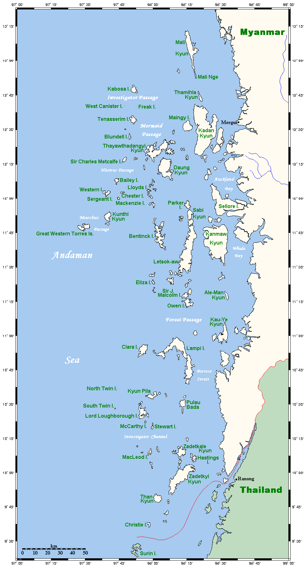
Map of the Mergui Archipelago in Myanmar. This map's source is here, with the uploader's modifications, and the GMT homepage says that the tools are released under the GNU General Public License. There is a somewhat bigger map of this area, showing places farther north and south. This is not on Wikipedia, but leave a message at my talk page if you would like such a thing, and likewise if you know any further information that ought to go on this map. |
|---|---|
| Source |
Originally from en.wikipedia; description page is/was here. |
| Date |
2006-05-14 (original upload date) |
| Author |
Original uploader was Kelisi at en.wikipedia |
| Permission (Reusing this image) |
Licensed under the GFDL by the author; Released under the GNU Free Documentation License. |
 |
This map image should be recreated using vector graphics as an SVG file. This has several advantages; see Commons:Media for cleanup for more information. If an SVG form of this image is already available, please upload it. After uploading an SVG, replace this template with template {{Vector version available|new image name.svg}} in this image. |
|
العربية | Български | Català | Česky | Dansk | Deutsch | English | Esperanto | Español | Français | 한국어 | Italiano | Magyar | Lietuvių | Nederlands | 日本語 | Polski | Português | Română | Русский | Suomi | Svenska | Türkçe | Українська | Tiếng Việt | मराठी | 中文(繁體) | 中文(简体) | +/- |
|
[edit] License information
|
NOTE: "subject to disclaimers" below may not actually apply, this was tagged with {{GFDL-user-en}}, and after May 2007, w:en:Template:GFDL-self did not require disclaimers. Please check the image description page on the English Wikipedia (or, if it has been deleted, ask an English Wikipedia administrator). See Wikipedia:GFDL standardization for details. |
|||
|
|||
|
Note: This tag should not be used. For images that were released on the English Wikipedia using either GFDL or GFDL-self with disclaimers, use {{GFDL-user-en-with-disclaimers}}. For images without disclaimers please use {{GFDL-user-en-no-disclaimers}} instead. If you are the copyright holder of files that were released on Wikipedia consider removing the disclaimers. |

[edit] Original upload log
(All user names refer to en.wikipedia)
- 2006-05-14 20:32 Kelisi 973×1808×8 (62506 bytes) Map of the Mergui Archipelago in Myanmar. This map's source is [http://www.aquarius.geomar.de/omc/make_map.html here], with the uploader's modifications, and the [http://gmt.soest.hawaii.edu/ GMT homepage] says that the tools are released under the GNU Ge
Historique du fichier
Cliquer sur une date et une heure pour voir le fichier tel qu’il était à ce moment-là
| Date et heure | Dimensions | Utilisateur | Commentaire | |
|---|---|---|---|---|
| actuel | 2 mai 2007 à 01:20 | 973×1 808 (61 Kio) | Ppntori | ({{Information |Description=Map of the Mergui Archipelago in Myanmar. This map's source is [http://www.aquarius.geomar.de/omc/make_map.html here], with the uploader's modifications, and the [http://gmt.soest.hawaii.edu/ GMT homepage] says that the tools ar) |
Pages contenant l’image
Les pages ci-dessous contiennent cette image :

