Image:Map of the United States 1823.jpg
Un article de Wikipédia, l'encyclopédie libre.
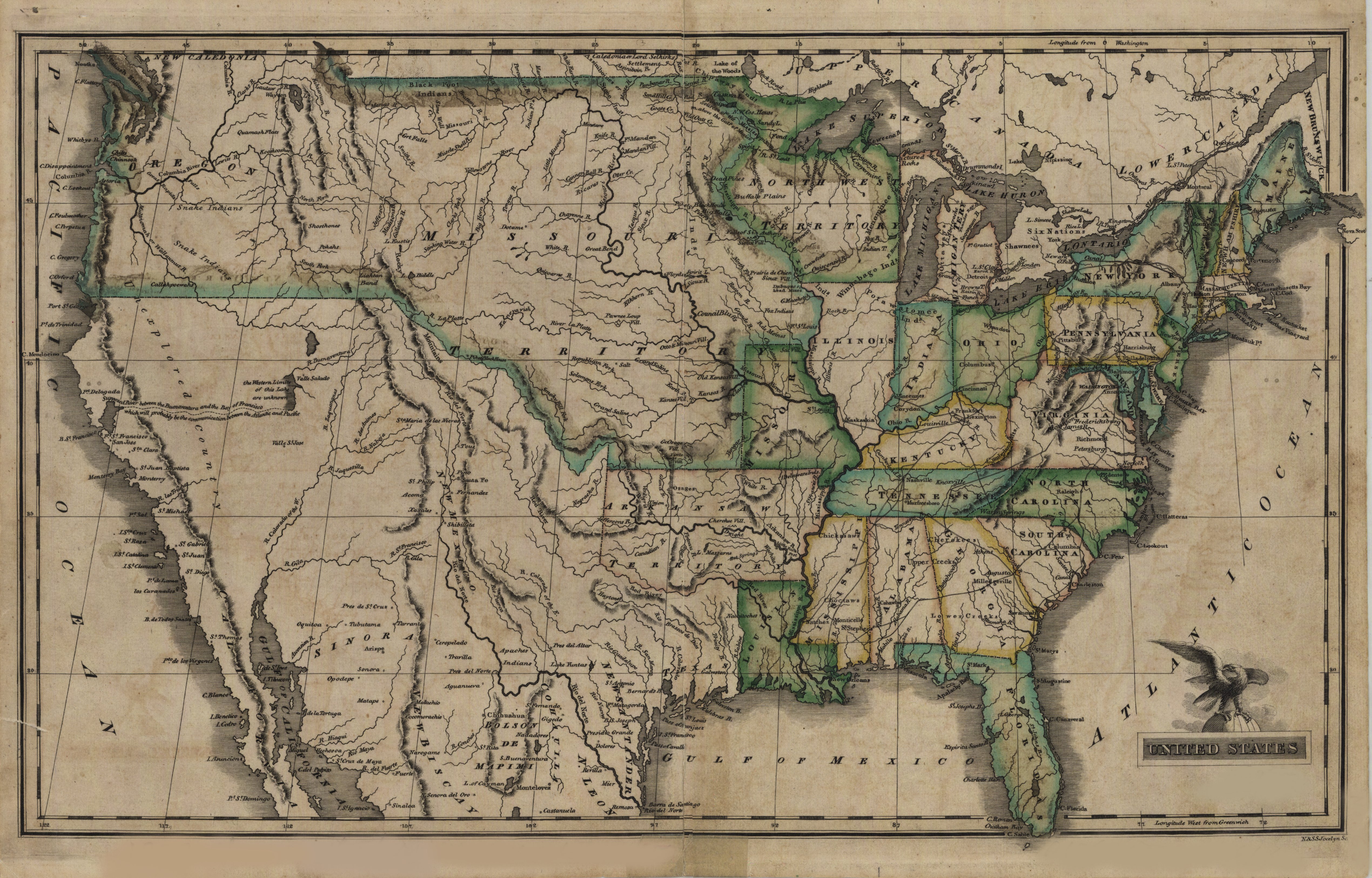
Taille de cet aperçu : 800 × 512 pixels
Image en plus haute résolution (5 080 × 3 251 pixels, taille du fichier : 3,44 Mio, type MIME : image/jpeg)
| | Ce fichier provient de Wikimedia Commons?. Les informations le concernant sont affichées ci-dessous (procédure). |
| Description |
Map of the United States, from: An atlas of the United States, on an improved plan; consisting of ten maps, with a complete index to each, and a general map of the whole country. By Sidney E. Morse, A.M. New-Haven: engraved and published by N. & S.S. Jocelyn. 1823 - Size: 24 x 42 cm - Engraved map. Outline hand color. Relief shown by hachures. Prime meridians: Washington and Greenwich - Scale 1: 11,300,000 (aprox.) |
||
|---|---|---|---|
| Source |
Mary B. Ansari Map Library, University of Nevada, Reno - http://contentdm.library.unr.edu/cdm4/item_viewer.php?CISOROOT=/hmaps&CISOPTR=1971&REC=5 |
||
| Date |
1823 |
||
| Author |
Drawing: Morse, Sidney E. (Sidney Edwards), 1794-1871, Engraving: N & SS Jocelyn |
||
| Permission (Reusing this image) |
|
||
| Other versions |
at the given website: ftp://nas.library.unr.edu/Keck/HistTopoNV/Historic_Maps/US_1823.djvu (246K) ftp://nas.library.unr.edu/Keck/HistTopoNV/Historic_Maps/US_1823.tif (48.3Mb) |
Historique du fichier
Cliquer sur une date et une heure pour voir le fichier tel qu’il était à ce moment-là
| Date et heure | Dimensions | Utilisateur | Commentaire | |
|---|---|---|---|---|
| actuel | 30 septembre 2007 à 00:31 | 5 080×3 251 (3,44 Mio) | H-stt | ({{Information |Description= Map of the United States, size 24 x 42 cm |Source= Mary B. Ansari Map Library, University of Nevada, Reno - http://contentdm.library.unr.edu/cdm4/item_viewer.php?CISOROOT=/hmaps&CISOPTR=1971&REC=5 |Date= 1823 |Author= N & SS J) |
Pages contenant l’image
La page ci-dessous contient cette image :

