Image:Map of Europe (political).png
Un article de Wikipédia, l'encyclopédie libre.
Taille de cet aperçu : 800 × 523 pixels
Image en plus haute résolution (1 596 × 1 043 pixels, taille du fichier : 108 Kio, type MIME : image/png)
| | Ce fichier provient de Wikimedia Commons?. Les informations le concernant sont affichées ci-dessous (procédure). |
 |
This map has been uploaded by Electionworld from en.wikipedia.org to enable the |
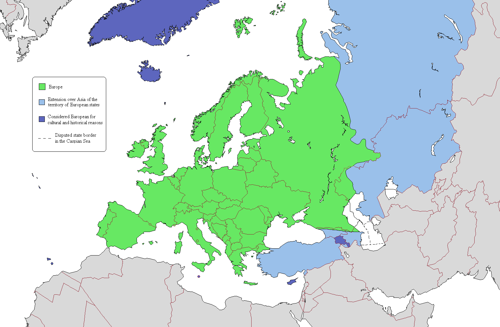
According to one common view of the boundary, the European continent is the area coloured green on this map. The light blue/dark blue colors are described here.
[edit] Licensing

[edit] Map Colors
Geographical Europe is colored green. The Asian territory of states that lie both in Europe and Asia are colored light blue. Dark-blue are colored states that lie entirely on the Asian continent, but are considered European because of religious, cultural and historical reasons. Azerbaijan's exclave of Nakhchivan is also coloured dark-blue because it is not a continuous extension of Azerbaijan's territory.
Historique du fichier
Cliquer sur une date et une heure pour voir le fichier tel qu’il était à ce moment-là
| Date et heure | Dimensions | Utilisateur | Commentaire | |
|---|---|---|---|---|
| actuel | 15 janvier 2007 à 23:02 | 1 596×1 043 (108 Kio) | Jon Harald Søby | (small change in Azerbaijan's colour) |
| 3 décembre 2006 à 16:06 | 1 596×1 043 (115 Kio) | Electionworld | ({[ew|en|Alinor}} According to one common view of the boundary, the European continent is the area coloured green on this map. The light blue/dark blue colors are described at [[Transcontinental nation#Countries in both Asia and) |
Pages contenant l’image
La page ci-dessous contient cette image :


.png)