Image:Map Kashmir Standoff 2003.png
Un article de Wikipédia, l'encyclopédie libre.
Taille de cet aperçu : 755 × 600 pixels
Image en plus haute résolution (885 × 703 pixels, taille du fichier : 58 Kio, type MIME : image/png)
| | Ce fichier provient de Wikimedia Commons?. Les informations le concernant sont affichées ci-dessous (procédure). |
[edit] Summary
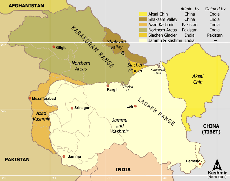
Kashmir region - Political and Military standoff between India, China and Pakistan
Self-made from Reference: Atlas of the World (2003 Comprehensive Ed.) - The w:Royal Geographical Society - (ISBN 0540084050)
[edit] Licensing

Historique du fichier
Cliquer sur une date et une heure pour voir le fichier tel qu’il était à ce moment-là
| Date et heure | Dimensions | Utilisateur | Commentaire | |
|---|---|---|---|---|
| actuel | 3 janvier 2006 à 19:36 | 885×703 (58 Kio) | Miljoshi | (Kashmir region - Political and Military standoff between India, China and Pakistan Reference: Atlas of the World (2003 Comprehensive Ed.) - The w:Royal Geographic Society - w:ISBN 0540084050 - Self-made.) |
Pages contenant l’image
La page ci-dessous contient cette image :

