Image:Liège agglomération Liège Belgium Map.PNG
Un article de Wikipédia, l'encyclopédie libre.
Pas de plus haute résolution disponible.
Liège_agglomération_Liège_Belgium_Map.PNG (290 × 220 pixels, taille du fichier : 7 Kio, type MIME : image/png)
| | Ce fichier provient de Wikimedia Commons?. Les informations le concernant sont affichées ci-dessous (procédure). |
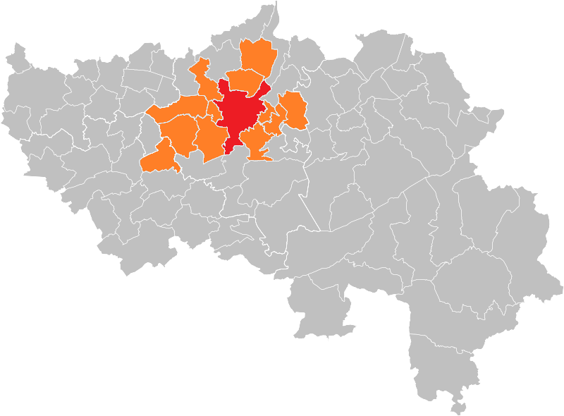
![]() Carte indiquant la localisation de l'agglomération de Liège (600000 habitants) dans la Province de Liège.
Carte indiquant la localisation de l'agglomération de Liège (600000 habitants) dans la Province de Liège.
![]() Map of the city of Liège (in red) and suburbs (in orange) in the Province of Liège.
Map of the city of Liège (in red) and suburbs (in orange) in the Province of Liège.
(Map from w:nl:Gebruiker:LennartBolks/kaartenhoekje in Public Domain by the Author choice)
| This image has been released into the public domain by its author, LennartBolks. This applies worldwide. In some countries this may not be legally possible; if so: العربية | Български | Deutsch | Ελληνικά | English | Español | Français | Italiano | 日本語 | 한국어 | Polski | Русский | Српски / Srpski | Svenska | தமிழ் | Українська | 中文(繁體) | 中文(简体) +/- |
Historique du fichier
Cliquer sur une date et une heure pour voir le fichier tel qu’il était à ce moment-là
| Date et heure | Dimensions | Utilisateur | Commentaire | |
|---|---|---|---|---|
| actuel | 22 décembre 2005 à 16:38 | 290×220 (7 Kio) | Jrenier | (Map, belgium, city of Liège ans suburbs (600000 people) {{PD}} FR; Carte indiquant la localisation de l'agglomération de Liège (600000 habitants) dans la Province de Liège. EN; Map from w:nl:Gebruiker:LennartBolks/kaartenhoekje in Public Domain b) |
Pages contenant l’image
La page ci-dessous contient cette image :

