Image:Kenya Map.png
Un article de Wikipédia, l'encyclopédie libre.
Taille de cet aperçu : 495 × 600 pixels
Image en plus haute résolution (1 002 × 1 214 pixels, taille du fichier : 237 Kio, type MIME : image/png)
| | Ce fichier provient de Wikimedia Commons?. Les informations le concernant sont affichées ci-dessous (procédure). |
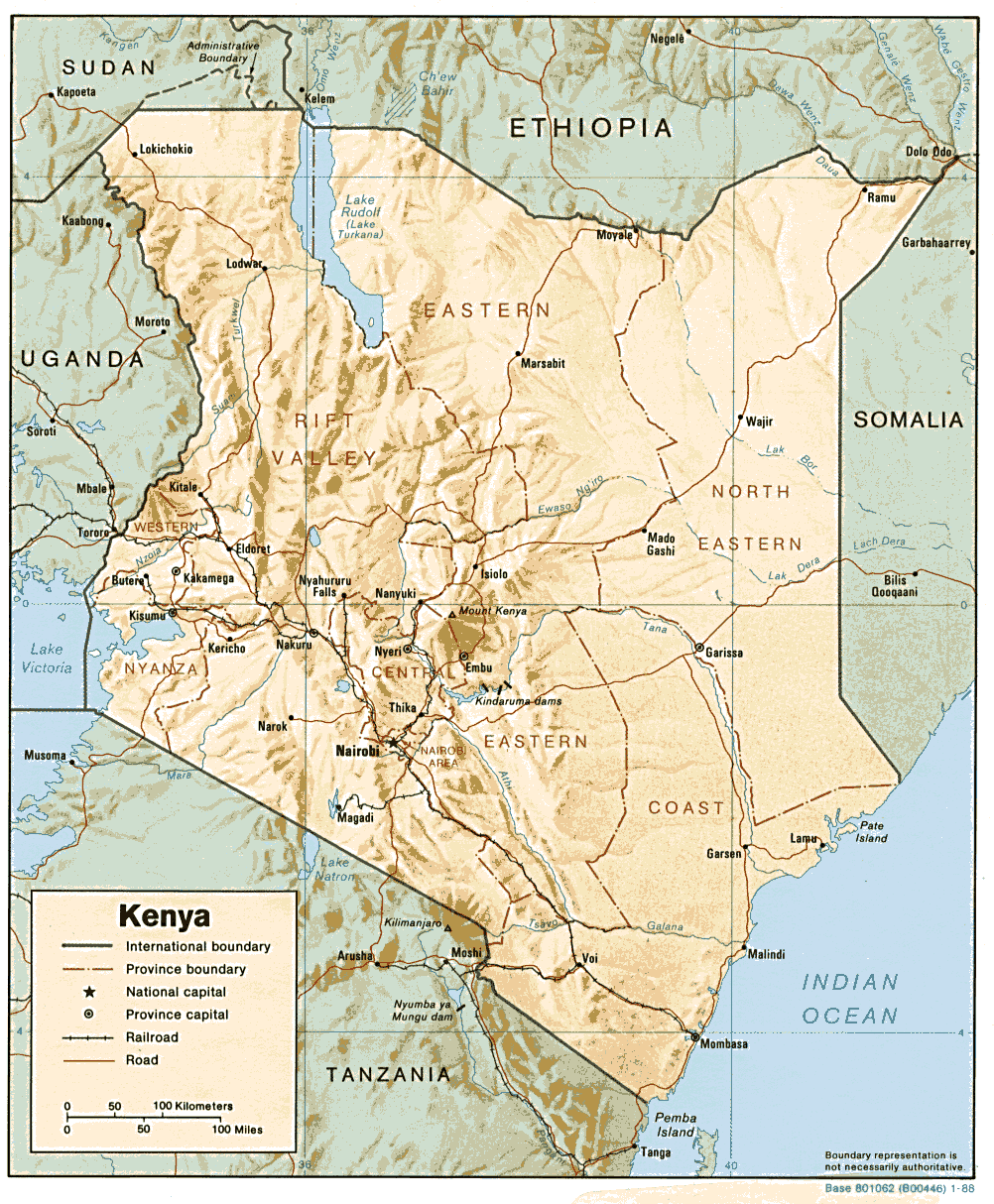
| Description |
English: Shaded relief map of Kenya
|
|---|---|
| Source | |
| Date | |
| Author | |
| Permission (Reusing this image) |
see below |
| Other versions | Image:Kenya-relief-map-towns.jpg (enlarged town names) |
| This image is a work of a Central Intelligence Agency employee, taken or made during the course of the person's official duties. As a Work of the United States Government, all images created or made by the CIA are in the public domain, with the exception of classified information. |  |
Historique du fichier
Cliquer sur une date et une heure pour voir le fichier tel qu’il était à ce moment-là
| Date et heure | Dimensions | Utilisateur | Commentaire | |
|---|---|---|---|---|
| actuel | 22 février 2006 à 15:17 | 1 002×1 214 (237 Kio) | Lupo | (Shaded relief map of Kenya. Source: [http://www.lib.utexas.edu/maps/africa/kenya.gif] from the [http://www.lib.utexas.edu/maps/kenya.html Perry-Castañeda Library Map Collection]. {{PD-USGov-CIA}} Category:Maps of Kenya) |
Pages contenant l’image
La page ci-dessous contient cette image :


![[1]](http://www.lib.utexas.edu/maps/africa/kenya.gif)