Image:Karte westwall.png
Un article de Wikipédia, l'encyclopédie libre.
Taille de cet aperçu : 345 × 600 pixels
Image en plus haute résolution (800 × 1 391 pixels, taille du fichier : 161 Kio, type MIME : image/png)
| | Ce fichier provient de Wikimedia Commons?. Les informations le concernant sont affichées ci-dessous (procédure). |
This is a featured picture on German Wikipedia and is considered one of the finest images.
|
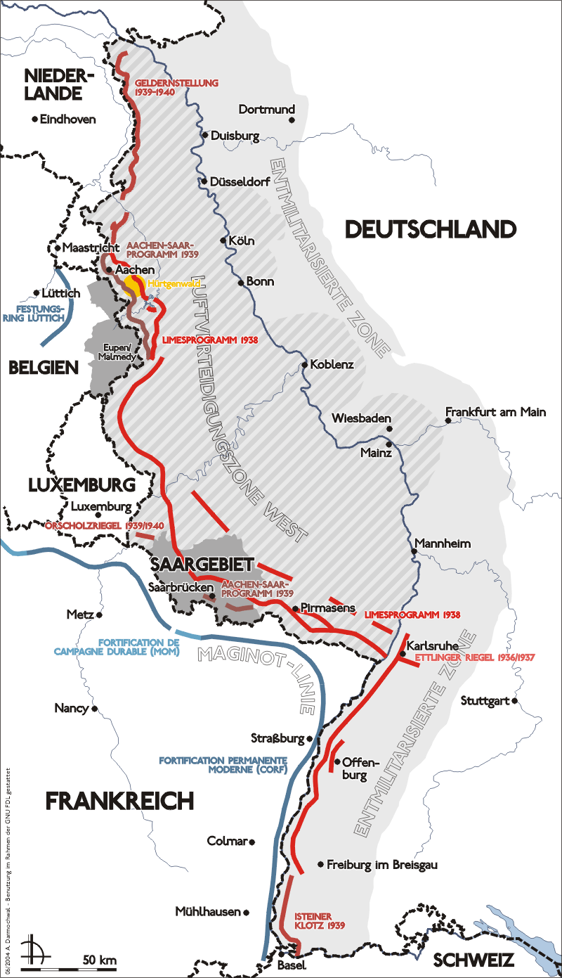
- Darstellung zeigt Lage, Verlauf und bauliche Entwicklung des Westwalls.
- Zeichnung erstellt 2004 von Sansculotte. Bild ist unter der GNU FDL zur weiteren Verwendung freigegeben.
- Quellenangabe und Beleg an sansculotte@despammed.com erbeten.
Source: German Wikipedia, original upload see file history

| This file is licensed under Creative Commons Attribution ShareAlike 2.0 Germany License
Diese Datei ist lizenziert unter der Creative-Commons-Lizenz Namensnennung-Weitergabe unter gleichen Bedingungen 2.0 Deutschland |
|
[edit] File history German Wikipedia
 (Löschen) (Aktuell) 18:56, 31. Aug 2004 . . Sansculotte (164472 Byte) (fehler korr.)
(Löschen) (Zurücksetzen) 14:56, 29. Jun 2004 . . Sansculotte (164346 Byte) (upd)
(Löschen) (Zurücksetzen) 04:40, 29. Jun 2004 . . Sansculotte (159356 Byte)
(Löschen) (Zurücksetzen) 04:14, 29. Jun 2004 . . Sansculotte (158019 Byte)
(Löschen) (Zurücksetzen) 00:48, 29. Jun 2004 . . Sansculotte (131228 Byte) (eigene Aufnahme, Nutzung gestattet unter der GNU/FDL und der cc-by-sa)
Historique du fichier
Cliquer sur une date et une heure pour voir le fichier tel qu’il était à ce moment-là
| Date et heure | Dimensions | Utilisateur | Commentaire | |
|---|---|---|---|---|
| actuel | 17 septembre 2005 à 12:15 | 800×1 391 (161 Kio) | Saperaud | (*Darstellung zeigt Lage, Verlauf und bauliche Entwicklung des Westwalls. *Zeichnung erstellt 2004 von Benutzer:Sansculotte. Bild ist unter der GNU FDL zur weiteren Verwendung freigegeben. *'''Quellenangabe und Beleg an [mailto:sansculotte@despamme) |
Pages contenant l’image
La page ci-dessous contient cette image :

