Image:Jackson Glacier terminus.jpg
Un article de Wikipédia, l'encyclopédie libre.
Taille de cet aperçu : 800 × 540 pixels
Image en plus haute résolution (900 × 608 pixels, taille du fichier : 131 Kio, type MIME : image/jpeg)
| | Ce fichier provient de Wikimedia Commons?. Les informations le concernant sont affichées ci-dessous (procédure). |
[edit] Summary
| Description |
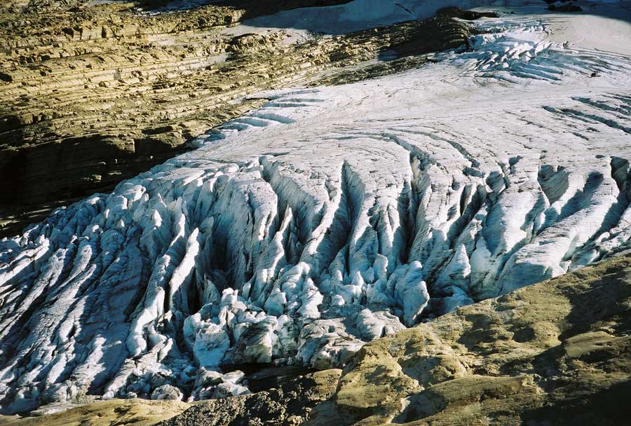
Image of the terminal end of Jackson Glacier in Glacier National Park (U.S.) |
|---|---|
| Source |
United States Geological Survey...from the following link [1], enlarged at [2] |
| Date | |
| Author |
USGS |
| Permission (Reusing this image) |
see below |
| Camera location |
|
Google Maps - Live Maps - Trails.com - TerraServer-USA |
|---|
[edit] Licensing
| This image is in the public domain because it contains materials that originally came from the United States Geological Survey, an agency of the United States Department of Interior. For more information, see the official USGS copyright policy |
|
Historique du fichier
Cliquer sur une date et une heure pour voir le fichier tel qu’il était à ce moment-là
| Date et heure | Dimensions | Utilisateur | Commentaire | |
|---|---|---|---|---|
| actuel | 20 janvier 2008 à 02:16 | 900×608 (131 Kio) | MONGO | ({{Information |Description=Image of the terminal end of Jackson Glacier in Glacier National Park (U.S.) |Source=United States Geological Survey...from the following link [http://www.nrmsc.usgs.g) |
Pages contenant l’image
La page ci-dessous contient cette image :


![[2]](http://www.nrmsc.usgs.gov/images/gcc/Jackson_terminus.jpg)