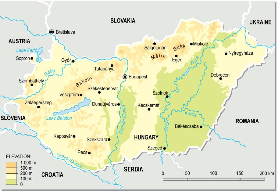
Image:Hungary topographic map.jpg
Un article de Wikipédia, l'encyclopédie libre.
Taille de cet aperçu : 800 × 549 pixels
Image en plus haute résolution (912 × 626 pixels, taille du fichier : 75 Kio, type MIME : image/jpeg)
| | Ce fichier provient de Wikimedia Commons?. Les informations le concernant sont affichées ci-dessous (procédure). |
 |
This map has been uploaded by Electionworld from en.wikipedia.org to enable the |
[edit] Summary
From a pd map collection. Mistakes fixed by User:cserlajos.
This image was (or all images in this article or category were) uploaded in the JPEG format.
However, it contains information that could be stored more efficiently or more accurately in the PNG format or SVG format. If possible, please upload a PNG or SVG version of this image without compression artifacts, derived from a non-JPEG source or with existing artifacts removed. After doing so, please:
- Find all pages in all Wikimedia projects that use this image, and replace the old image with the new image in each.
- Mark this image as having been superseded by adding one of these templates.
Deutsch | English | Español | Français | 日本語 | Português | Русский | +/-
[edit] Licensing
|
|
|
Note: This tag should not be used anymore! Please use instead:
|
Historique du fichier
Cliquer sur une date et une heure pour voir le fichier tel qu’il était à ce moment-là
| Date et heure | Dimensions | Utilisateur | Commentaire | |
|---|---|---|---|---|
| actuel | 24 décembre 2006 à 01:51 | 912×626 (75 Kio) | Electionworld | ({{ew|en|Cserlajos}} == Summary == From a pd map collection. Mistakes fixed by User:cserlajos. == Licensing == {{no rights reserved}} ) |
Pages contenant l’image
La page ci-dessous contient cette image :

