Image:HongKong boundary from space.png
Un article de Wikipédia, l'encyclopédie libre.
Taille de cet aperçu : 800 × 517 pixels
Image en plus haute résolution (1 024 × 662 pixels, taille du fichier : 1,38 Mio, type MIME : image/png)
| | Ce fichier provient de Wikimedia Commons?. Les informations le concernant sont affichées ci-dessous (procédure). |
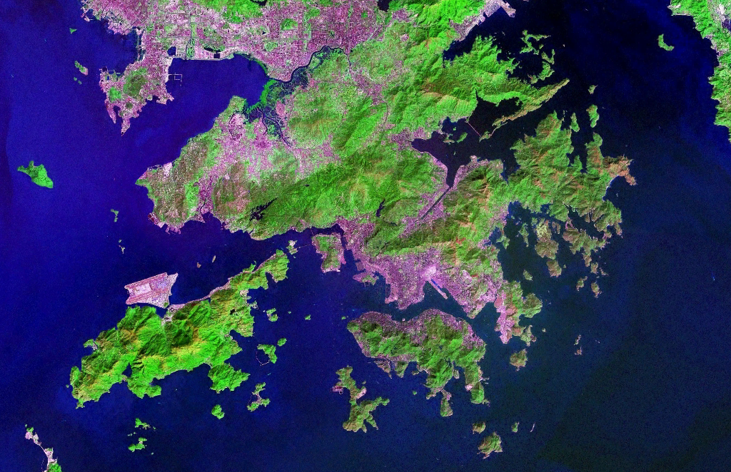
| Description |
Satellite Image of Hong Kong |
|||
|---|---|---|---|---|
| Source |
NASA World Wind Software |
|||
| Date |
07:20, 5 November 2006 (UTC) |
|||
| Author |
NASA |
|||
| Permission (Reusing this image) |
|
|||
| Other versions | Image:Hong Kong anotated zh.gif |
Historique du fichier
Cliquer sur une date et une heure pour voir le fichier tel qu’il était à ce moment-là
| Date et heure | Dimensions | Utilisateur | Commentaire | |
|---|---|---|---|---|
| actuel | 5 novembre 2006 à 09:20 | 1 024×662 (1,38 Mio) | Tonync | ({{Information |Description= Satellite Image of Hong Kong |Source= NASA World Wind Software |Date= ~~~~~ |Author= NASA |Permission= {{NASA}} |other_versions= }} Category:Satellite pictures of Hong Kong) |
Pages contenant l’image
La page ci-dessous contient cette image :

