Image:Gr-triple-occupation.png
Un article de Wikipédia, l'encyclopédie libre.
Taille de cet aperçu : 588 × 600 pixels
Image en plus haute résolution (899 × 917 pixels, taille du fichier : 82 Kio, type MIME : image/png)
| | Ce fichier provient de Wikimedia Commons?. Les informations le concernant sont affichées ci-dessous (procédure). |
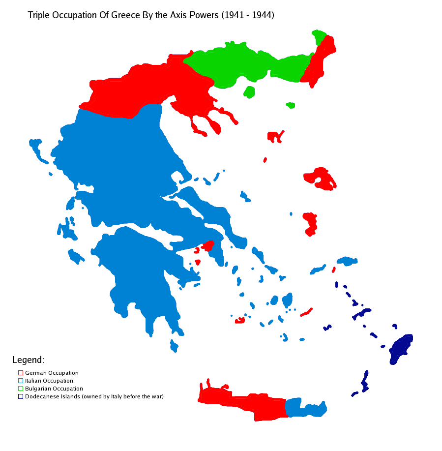
| Description |
Map showning the zones of control of the three occupying powers in Greece during WW2, from 1941 to 1944. English: Map of Occupied Greece showing the German and Italian occupation zones on Crete.
Svenska: Axelmakternas ockupationszoner under andra världskriget: blått Italien, grönt Bulgarien och rött Tyskland
Türkçe: Üçlü işgâl sürecinde Yunanistan
|
||||
|---|---|---|---|---|---|
| Source |
Own work |
||||
| Date |
17/10/2006 |
||||
| Author | |||||
| Permission (Reusing this image) |
|||||
| Other versions |
|


The image was created by me using another map as a template. This image was created using the Gimp.
Historique du fichier
Cliquer sur une date et une heure pour voir le fichier tel qu’il était à ce moment-là
| Date et heure | Dimensions | Utilisateur | Commentaire | |
|---|---|---|---|---|
| actuel | 22 mai 2006 à 17:48 | 899×917 (82 Kio) | GhePeU | (slightly reworked image) |
| 2 juillet 2005 à 18:06 | 899×917 (107 Kio) | Michalis Famelis | (Map showning the zones of control of the three occupying powers in Greece during WW2, from 1941 to 1944. The image was created by me using another map as a template. This image was created using the Gimp. {{GFDL}}) |
Pages contenant l’image
La page ci-dessous contient cette image :

