Image:Firthofclydemap.png
Un article de Wikipédia, l'encyclopédie libre.
Taille de cet aperçu : 531 × 600 pixels
Image en plus haute résolution (541 × 611 pixels, taille du fichier : 18 Kio, type MIME : image/png)
| | Ce fichier provient de Wikimedia Commons?. Les informations le concernant sont affichées ci-dessous (procédure). |
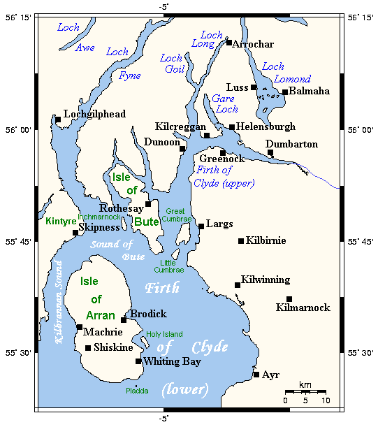
Map of the Firth of Clyde and surrounding lands and waters on the western coast of Scotland.
This map's source is here, with the uploader's modifications, and the GMT homepage says that the tools are released under the GNU General Public License.

Historique du fichier
Cliquer sur une date et une heure pour voir le fichier tel qu’il était à ce moment-là
| Date et heure | Dimensions | Utilisateur | Commentaire | |
|---|---|---|---|---|
| actuel | 29 septembre 2006 à 11:59 | 541×611 (18 Kio) | Voyager | (Map of the Firth of Clyde and surrounding lands and waters on the western coast of Scotland. This map's source is [http://www.aquarius.geomar.de/omc/make_map.html here], with the uploader's modifications, and the [http://gmt.soest.hawaii.edu/ GMT homepag) |
Pages contenant l’image
La page ci-dessous contient cette image :

