Image:Europe map 450.PNG
Un article de Wikipédia, l'encyclopédie libre.
Pas de plus haute résolution disponible.
Europe_map_450.PNG (800 × 580 pixels, taille du fichier : 141 Kio, type MIME : image/png)
| | Ce fichier provient de Wikimedia Commons?. Les informations le concernant sont affichées ci-dessous (procédure). |
[edit] Summary
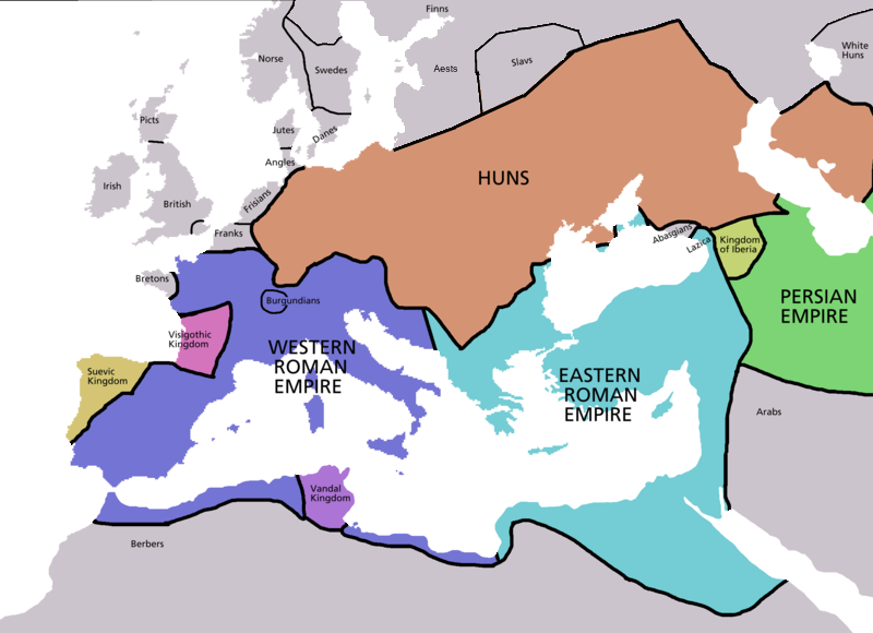
Map of Europe in 450 CE, based on free map of europe Image:BlankMap-Europe.png. Many of the border lines are approximations. Information from Penguin atlas of medieval history.
 |
This map image should be recreated using vector graphics as an SVG file. This has several advantages; see Commons:Media for cleanup for more information. If an SVG form of this image is already available, please upload it. After uploading an SVG, replace this template with template {{Vector version available|new image name.svg}} in this image. |
|
العربية | Български | Català | Česky | Dansk | Deutsch | English | Esperanto | Español | Français | 한국어 | Italiano | Magyar | Lietuvių | Nederlands | 日本語 | Polski | Português | Română | Русский | Suomi | Svenska | Türkçe | Українська | Tiếng Việt | मराठी | 中文(繁體) | 中文(简体) | +/- |
|
| Maps of the history of Europe | |
| BC aC |
|
|
|
|
| AD dC |
60 · 395 · 400 · 450 · 476 · 526 · 526-600 · 800 · 814 · 843-870 · 998 · 1000 · 1092 · 1097 · 1142 · 1190 · 1328 · 1360 · C.15 · 1430 · 1470 · 1490 · 1550 · 1648 · 1700 · 1708 · 1740 · 1812 · 1814 · 1815 · 1890 · 1905 · 1911 · 1914-24 · 1919-29 · 1941-42 · 1942-45 · 1945-89 · 1993-2006 · 2006 to date |
| (this template: · view · discuss ) | |
[edit] Licensing

Historique du fichier
Cliquer sur une date et une heure pour voir le fichier tel qu’il était à ce moment-là
| Date et heure | Dimensions | Utilisateur | Commentaire | |
|---|---|---|---|---|
| actuel | 12 janvier 2007 à 04:52 | 800×580 (141 Kio) | Roke | |
| 5 mai 2006 à 15:38 | 2 275×1 649 (111 Kio) | Roke | (Map of Europe in 220BC, based on free map of europe Image:BlankMap-Europe.png. Many of the border lines are approximations. {{Europe}} Category: Historical maps of Europe) |
Pages contenant l’image
Les pages ci-dessous contiennent cette image :

