Image:Death Valley NP master map.png
Un article de Wikipédia, l'encyclopédie libre.
Taille de cet aperçu : 546 × 599 pixels
Image en plus haute résolution (853 × 936 pixels, taille du fichier : 1,22 Mio, type MIME : image/png)
| | Ce fichier provient de Wikimedia Commons?. Les informations le concernant sont affichées ci-dessous (procédure). |
[edit] Summary
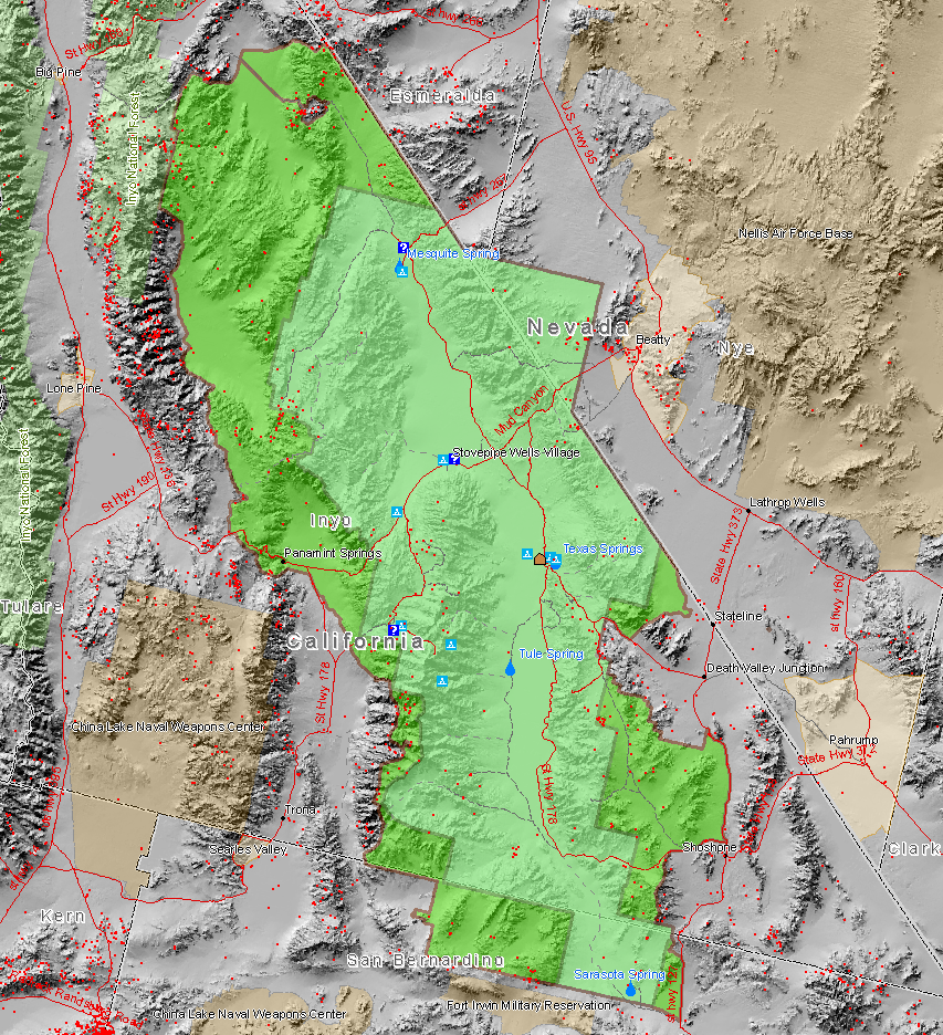
Map created by Daniel Mayer using data from the National Park Service metadata
Red dots are mine sites, blue triangles are camp sites, and blue question marks are tourist information facilities. This map also shows the old borders of Death Valley National Monument and the new borders of the expanded national park.
[edit] Licensing
|
Historique du fichier
Cliquer sur une date et une heure pour voir le fichier tel qu’il était à ce moment-là
| Date et heure | Dimensions | Utilisateur | Commentaire | |
|---|---|---|---|---|
| actuel | 9 mars 2006 à 03:30 | 853×936 (1,22 Mio) | Maveric149 | (Map created by Daniel Mayer using data from the National Park Service [http://science.nature.nps.gov/nrdata/metadata.cfm?ID=16872 metadata]) |
Pages contenant l’image
Les pages ci-dessous contiennent cette image :

