Image:DC locator map with state names w usmap.png
Un article de Wikipédia, l'encyclopédie libre.
Pas de plus haute résolution disponible.
DC_locator_map_with_state_names_w_usmap.png (252 × 196 pixels, taille du fichier : 62 Kio, type MIME : image/png)
| | Ce fichier provient de Wikimedia Commons?. Les informations le concernant sont affichées ci-dessous (procédure). |
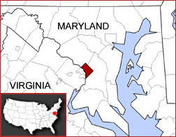
Map created by Kmf164-maps (with the same name) in the English Wikipedia, under the cc-by-sa-2.5 licence.
| This file is licensed under the Creative Commons Attribution ShareAlike 2.5 License. In short: you are free to share and make derivative works of the file under the conditions that you appropriately attribute it, and that you distribute it only under a license identical to this one. Official license |
 |
This map image should be recreated using vector graphics as an SVG file. This has several advantages; see Commons:Media for cleanup for more information. If an SVG form of this image is already available, please upload it. After uploading an SVG, replace this template with template {{Vector version available|new image name.svg}} in this image. |
|
العربية | Български | Català | Česky | Dansk | Deutsch | English | Esperanto | Español | Français | 한국어 | Italiano | Magyar | Lietuvių | Nederlands | 日本語 | Polski | Português | Română | Русский | Suomi | Svenska | Türkçe | Українська | Tiếng Việt | मराठी | 中文(繁體) | 中文(简体) | +/- |
|
Historique du fichier
Cliquer sur une date et une heure pour voir le fichier tel qu’il était à ce moment-là
| Date et heure | Dimensions | Utilisateur | Commentaire | |
|---|---|---|---|---|
| actuel | 26 janvier 2006 à 06:44 | 252×196 (62 Kio) | Leslie | (Map created by user:Kmf164-maps (with the same name) in the English Wikipedia, under the ''cc-by-sa-2.5'' licence. Category:Kmf164-maps {{cc-by-sa-2.5}}) |
Pages contenant l’image
La page ci-dessous contient cette image :

