Image:CapeHorn ASTER 2005sep20.jpg
Un article de Wikipédia, l'encyclopédie libre.
Taille de cet aperçu : 768 × 599 pixels
Image en plus haute résolution (3 207 × 2 503 pixels, taille du fichier : 875 Kio, type MIME : image/jpeg)
| | Ce fichier provient de Wikimedia Commons?. Les informations le concernant sont affichées ci-dessous (procédure). |
[edit] Summary
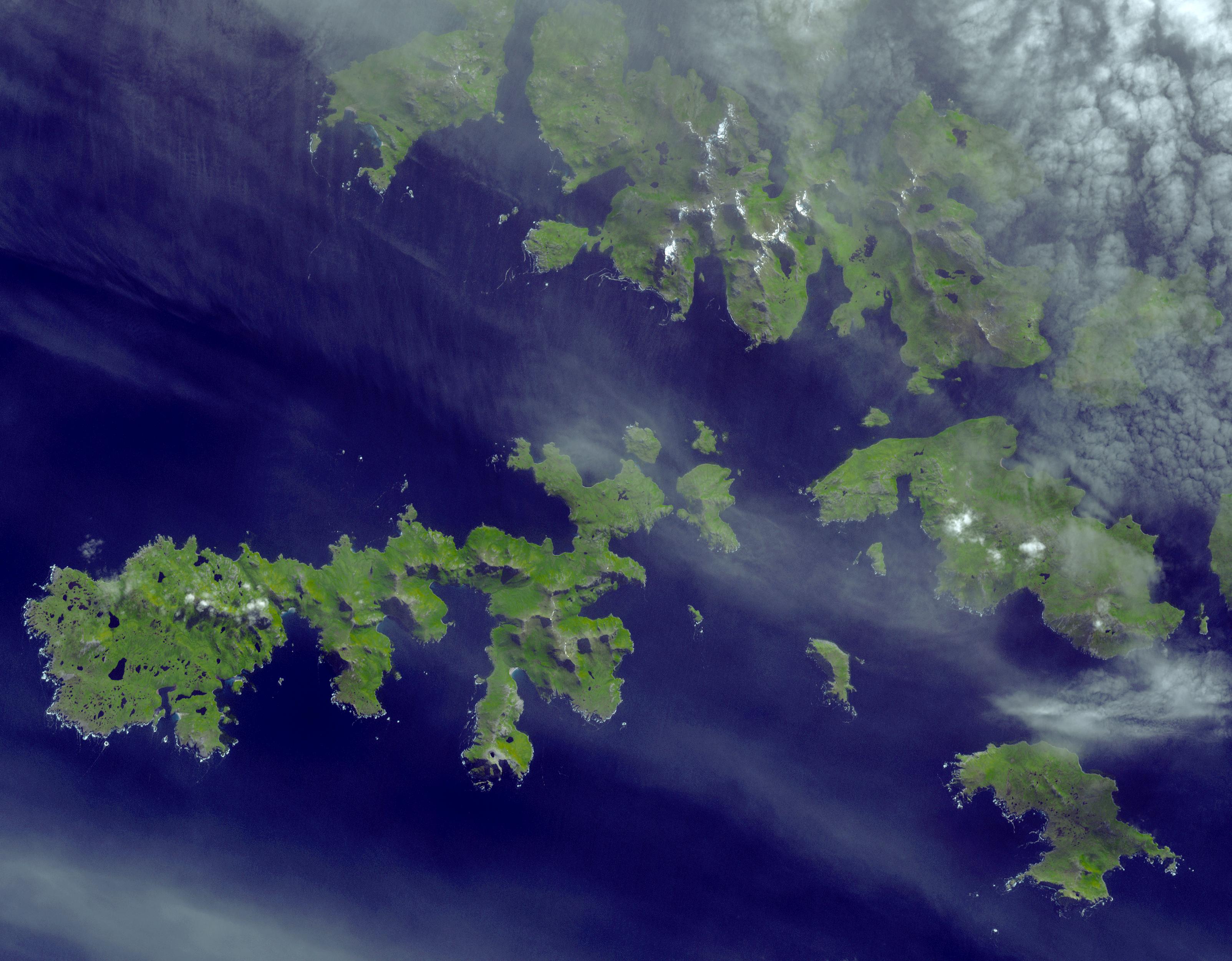
| Description |
Satellite image of the w:Wollaston Islands (upper right), the w:Hermite Islands (center) and w:Cape Horn (lower right) |
|---|---|
| Source |
http://earthobservatory.nasa.gov/Newsroom/NewImages/images.php3?img_id=17271 |
| Date |
September 20, 2005 |
| Author |
NASA/GSFC/METI/ERSDAC/JAROS, and U.S./Japan ASTER Science Team |
| Permission (Reusing this image) |
Public domain |
[edit] Licensing
|
|
This file is in the public domain because it was created by NASA. NASA copyright policy states that "NASA material is not protected by copyright unless noted". (NASA copyright policy page or JPL Image Use Policy).
Deutsch | English | Español | Français | Nederlands | Português | Русский | 中文(简体) | 中文(繁體) | +/- |
|
 |
Warnings:
|
Historique du fichier
Cliquer sur une date et une heure pour voir le fichier tel qu’il était à ce moment-là
| Date et heure | Dimensions | Utilisateur | Commentaire | |
|---|---|---|---|---|
| actuel | 11 mai 2006 à 21:58 | 3 207×2 503 (875 Kio) | Howcheng | ({{Information | Description=Satellite image of the w:Hermite Islands and w:Cape Horn. | Source=http://earthobservatory.nasa.gov/Newsroom/NewImages/images.php3?img_id=17271 | Date=September 20, 2005 | Author=NASA/GSFC/METI/ERSDAC/JAROS, and U.S./Ja) |
Pages contenant l’image
Les pages ci-dessous contiennent cette image :

