Image:BlueLine.jpg
Un article de Wikipédia, l'encyclopédie libre.
Taille de cet aperçu : 800 × 553 pixels
Image en plus haute résolution (1 299 × 898 pixels, taille du fichier : 238 Kio, type MIME : image/jpeg)
| | Ce fichier provient de Wikimedia Commons?. Les informations le concernant sont affichées ci-dessous (procédure). |
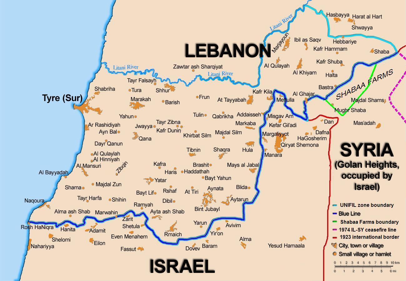
[edit] Summary
Map showing the Blue Line demarcation line between Lebanon and Israel, established by the UN after the Israeli withdrawal from southern Lebanon after its short 1978 invasion called "Operation Litani". It follows the 1949 cease-fire line, also known as the Green Line, as well as the somewhat contested Lebanese-Syrian border towards the Israeli-occupied Golan Heights. The map is made by Thomas Blomberg, using the UNIFIL map, deployment as of July 2006 as source.
[edit] Licensing
|
Historique du fichier
Cliquer sur une date et une heure pour voir le fichier tel qu’il était à ce moment-là
| Date et heure | Dimensions | Utilisateur | Commentaire | |
|---|---|---|---|---|
| actuel | 17 août 2006 à 18:30 | 1 299×898 (238 Kio) | Thomas Blomberg | |
| 4 août 2006 à 16:16 | 1 299×898 (643 Kio) | Thomas Blomberg | (Map showing the Blue Line demarkation line between Lebanon and Israel, established by the UN after the Israeli withdrawal from southern Lebanon after its short 1978 invasion called "Operation Litani". It follows the 1949 cease-fire line, also known as the) |
Pages contenant l’image
La page ci-dessous contient cette image :

