Image:Al-Idrisi's world map.JPG
Un article de Wikipédia, l'encyclopédie libre.
Taille de cet aperçu : 550 × 599 pixels
Image en plus haute résolution (1 424 × 1 552 pixels, taille du fichier : 917 Kio, type MIME : image/jpeg)
| | Ce fichier provient de Wikimedia Commons?. Les informations le concernant sont affichées ci-dessous (procédure). |
[edit] Summary
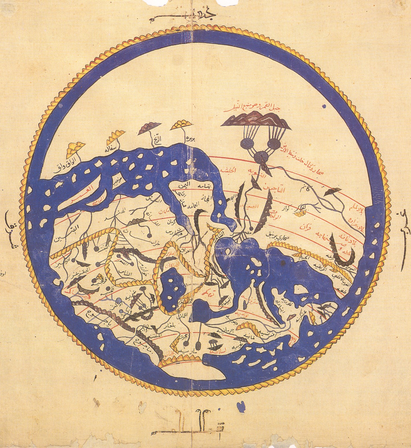
en:al-Idrisi world map, Arabic from 804/1154/1456 A.D.
Note that south is at the top of the map.
- Oriented with South at the top
- Public domain because of age.
First version taken from [1], more specifically [2]. Second version was losslessly rotaded and cropped from [3]
According to the Bibliotheque Nationale de France, "Ten copies of the Kitab Rujar exist worldwide today. Of these ten, six contain at the start of the work a circular map of the world which is not mentioned in the text of al-Idris". [4]
The image here is from a manuscript copied by 'Alî ibn Hasan al-Hûfî al-Qâsimî in Cairo in 1456, now preserved in the Bodleian Library in Oxford. (Mss. Pococke 375 fol. 3v-4)
[edit] Versions
 Original picture. |
 This version (cropped). |
 More cropped. |
 Wikimedia user awards |
[edit] Licensing
This photographic reproduction is therefore also in the public domain. العربية | Česky | Deutsch | English | Ελληνικά | Español | فارسی | Français | עברית | Bahasa Indonesia | Italiano | 日本語 | 한국어 | Magyar | Nederlands | Polski | Português | Română | Русский | Slovenščina | Српски / Srpski | Basa Sunda | Türkçe | Українська | 中文(繁體) | 中文(简体) | +/- |
Historique du fichier
Cliquer sur une date et une heure pour voir le fichier tel qu’il était à ce moment-là
| Date et heure | Dimensions | Utilisateur | Commentaire | |
|---|---|---|---|---|
| actuel | 23 août 2006 à 05:53 | 1 424×1 552 (917 Kio) | Leinad-Z | (Losslessly rotaded and cropped from http://www.sindominio.net/labiblio/varios/IdrisiMap.jpg) |
| 8 avril 2005 à 15:55 | 492×570 (72 Kio) | EugeneZelenko | (Al-Idrisi's world map from 1154. Note that south is at the top of the map. Originally uploaded to English Wikipedia by en:User: SimonP (06:19, 8 Dec 2004). {{PD}}) |
Pages contenant l’image
Les pages ci-dessous contiennent cette image :


![[2]](http://www.henry-davis.com/MAPS/EMimages/219.JPG)
![[3]](http://www.sindominio.net/labiblio/varios/IdrisiMap.jpg)