Image:Aerial view of Nauru.jpg
Un article de Wikipédia, l'encyclopédie libre.
Taille de cet aperçu : 800 × 594 pixels
Image en plus haute résolution (1 600 × 1 187 pixels, taille du fichier : 401 Kio, type MIME : image/jpeg)
| | Ce fichier provient de Wikimedia Commons?. Les informations le concernant sont affichées ci-dessous (procédure). |
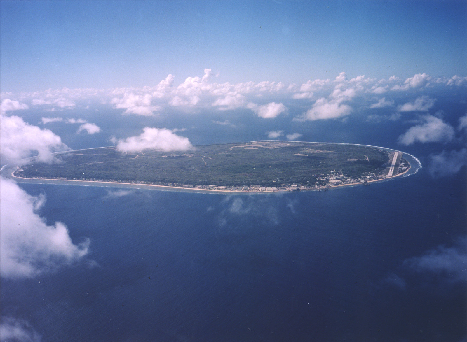
A limestone karst on Nauru Island as a result of the over-mining of phosphate.
Courtesy: U.S. Department of Energy's Atmospheric Radiation Measurement Program.
Source: [1] (http://www.arm.gov/)
| This photograph was produced by the Atmospheric Radiation Measurement Program.
Their site states:
Additionally, the ARM program is part of the U.S. Department of Energy, whose images are in the public domain. |
Historique du fichier
Cliquer sur une date et une heure pour voir le fichier tel qu’il était à ce moment-là
| Date et heure | Dimensions | Utilisateur | Commentaire | |
|---|---|---|---|---|
| actuel | 3 avril 2007 à 04:13 | 1 600×1 187 (401 Kio) | Indolences | (A limestone karst on Nauru Island as a result of the over-mining of phosphate. ''Courtesy: U.S. Department of Energy's Atmospheric Radiation Measurement Program.'' Source: [http://images.arm.gov/armimages.nsf/by+id/TENG-5JGSKP] (http://www.arm.gov/) {{) |
Pages contenant l’image
La page ci-dessous contient cette image :
Métadonnées
Ce fichier contient des informations supplémentaires probablement ajoutées par l’appareil photo numérique ou le numériseur qui l’a acquis. Si le fichier a été modifié depuis son état original, certains détails peuvent ne pas refléter entièrement l’image modifiée.
| Largeur | 1600 |
|---|---|
| Hauteur | 1187 |
| Type de compression | Non compressé |
| Modèle colorimétrique | RGB |
| Orientation | Normale |
| Composantes par pixel | 3 |
| Résolution horizontale | 200 dpi |
| Résolution verticale | 200 dpi |
| Arrangement des données | Données contiguës |
| Logiciel utilisé | Adobe Photoshop CS2 Windows |
| Date de modification | 2 avril 2007 à 19:05 |
| Espace colorimétrique | 65535 |

