Image:7 zones dels ciclons tropicals.jpg
Un article de Wikipédia, l'encyclopédie libre.
Taille de cet aperçu : 800 × 332 pixels
Image en plus haute résolution (1 780 × 738 pixels, taille du fichier : 211 Kio, type MIME : image/jpeg)
| | Ce fichier provient de Wikimedia Commons?. Les informations le concernant sont affichées ci-dessous (procédure). |
| Description |
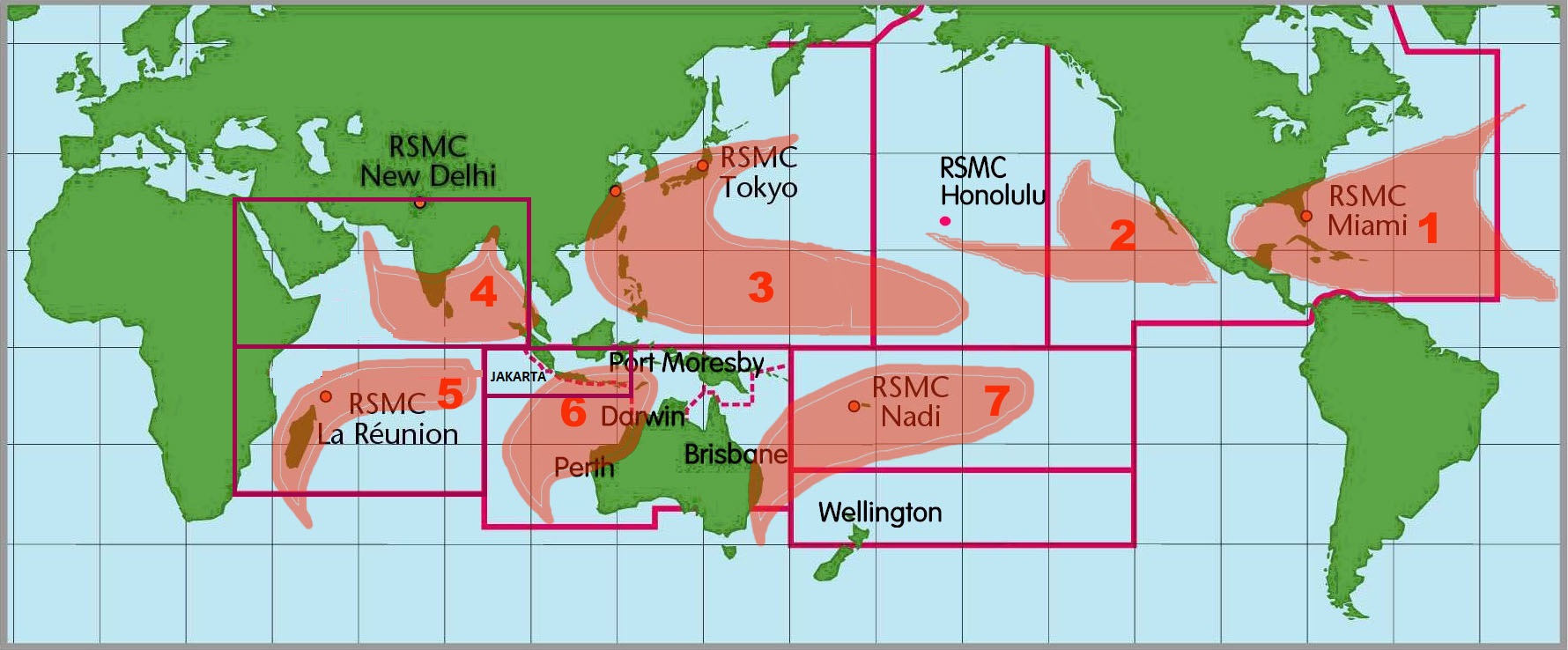
Images of the seven tropical cyclone "basins" where storms occur on a regular basis around the world and the Regional Speciliazed Meteorological Centers in charge. |
|||
|---|---|---|---|---|
| Source | ||||
| Date |
00:08, 22 October 2005 (UTC) |
|||
| Author | ||||
| Permission (Reusing this image) |
|
|||
| Other versions | Image:6RSMCs.jpg |
Historique du fichier
Cliquer sur une date et une heure pour voir le fichier tel qu’il était à ce moment-là
| Date et heure | Dimensions | Utilisateur | Commentaire | |
|---|---|---|---|---|
| actuel | 22 octobre 2005 à 02:08 | 1 780×738 (211 Kio) | Xadaga | ({{DP-NOAA}} Mapamundi amb les 7 àrees on s'originen ciclons tropicals. Imatge extreta de la NOAA. [http://www.aoml.noaa.gov/hrd/tcfaq/F1.html]) |
Pages contenant l’image
Les pages ci-dessous contiennent cette image :
Métadonnées
Ce fichier contient des informations supplémentaires probablement ajoutées par l’appareil photo numérique ou le numériseur qui l’a acquis. Si le fichier a été modifié depuis son état original, certains détails peuvent ne pas refléter entièrement l’image modifiée.
| Orientation | Normale |
|---|---|
| Résolution horizontale | 72 dpi |
| Résolution verticale | 72 dpi |
| Logiciel utilisé | Adobe Photoshop 7.0 |
| Date de modification | 8 janvier 2004 à 09:44 |
| Espace colorimétrique | 65535 |

