Image:1998 Ice Storm map.png
Un article de Wikipédia, l'encyclopédie libre.
Taille de cet aperçu : 800 × 412 pixels
Image en plus haute résolution (1 500 × 772 pixels, taille du fichier : 519 Kio, type MIME : image/png)
| | Ce fichier provient de Wikimedia Commons?. Les informations le concernant sont affichées ci-dessous (procédure). |
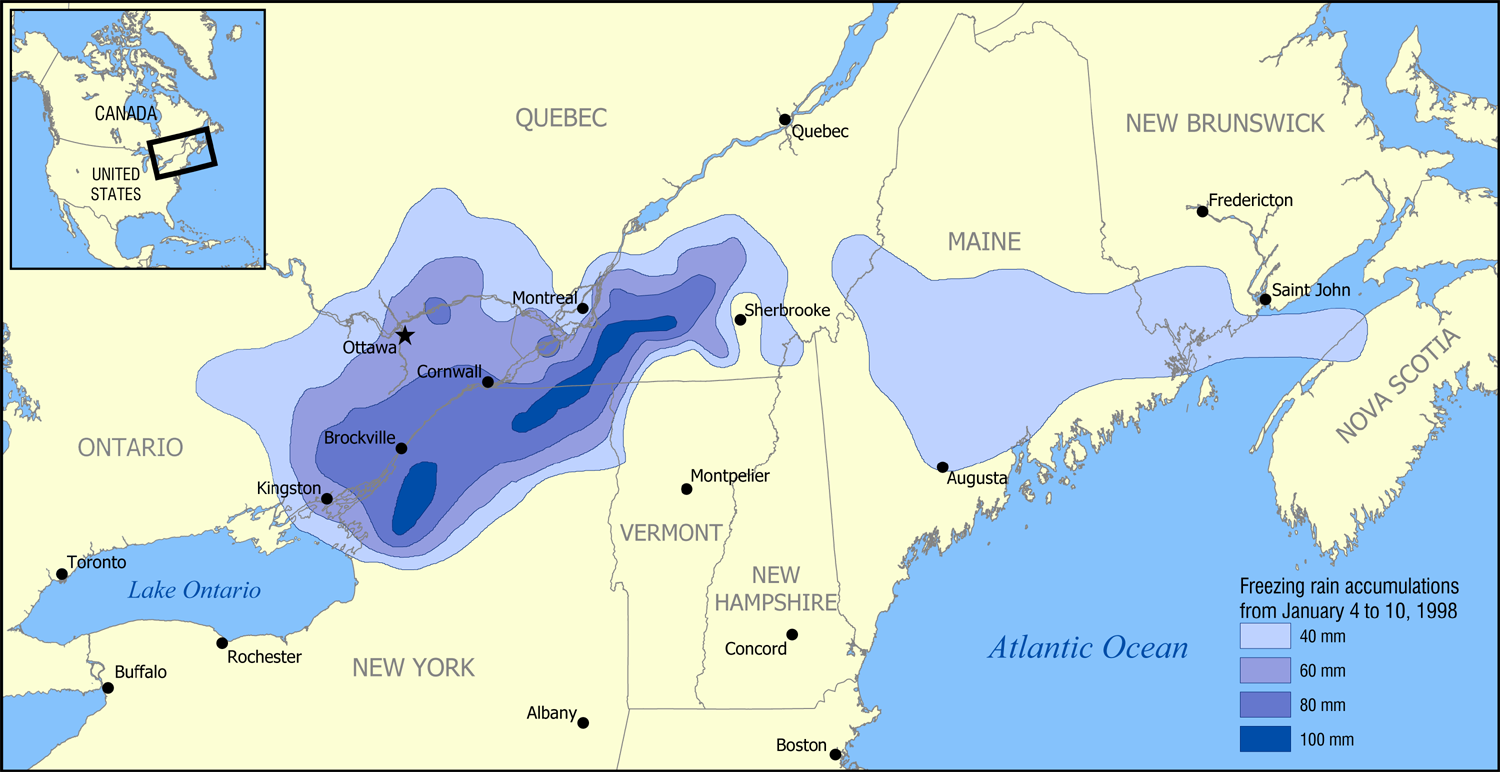
A map showing the extent of the 1998 Ice Storm that affected eastern Ontario, southwest Quebec, New Brunswick, and parts of New York, Vermont, New Hampshire, and Maine.
The map shows the accumulation of ice in millimetres from January 4 to January 10, 1998.
Based on data from Environment Canada [1].
Created by NormanEinstein, January 30, 2006.

Historique du fichier
Cliquer sur une date et une heure pour voir le fichier tel qu’il était à ce moment-là
| Date et heure | Dimensions | Utilisateur | Commentaire | |
|---|---|---|---|---|
| actuel | 30 janvier 2006 à 19:52 | 1 500×772 (519 Kio) | NormanEinstein | (A map showing the extent of the 1998 Ice Storm that affected eastern Ontario, southwest Quebec, New Brunswick, and parts of New York, Vermont, New Hampshire, and Maine. The map shows the accumulation of ice in millimetres from January 4 to January 10, 19) |
Pages contenant l’image
La page ci-dessous contient cette image :


![[1]](http://www.msc-smc.ec.gc.ca/media/icestorm98/maps/national_web_zr.gif)