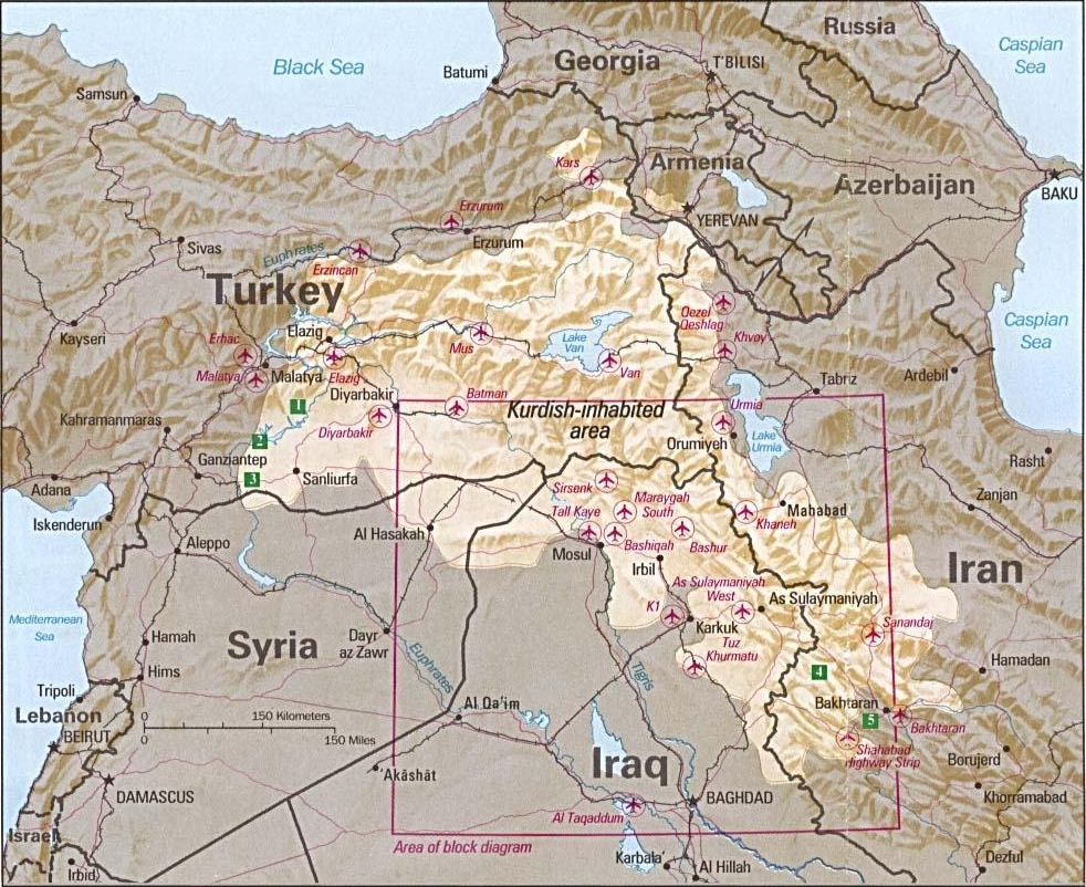
Image:Kurdish-inhabited area by CIA (1992).jpg
Un article de Wikipédia, l'encyclopédie libre.
Taille de cet aperçu : 734 × 599 pixels
Image en plus haute résolution (982 × 802 pixels, taille du fichier : 630 Kio, type MIME : image/jpeg)
| | Ce fichier provient de Wikimedia Commons?. Les informations le concernant sont affichées ci-dessous (procédure). |
Summary
Kurdish-inhabited area by CIA (1992)
- Source: Perry-Castañeda Library Map Collection at The University of Texas at Austin [1]
- License: Above a list of maps available for download, the web site has the text: The following maps were produced by the U.S. Central Intelligence Agency, unless otherwise indicated.. There is no indication that this map was not produced by the CIA.
Περίληψη
Περιοχές κατοικούμενες από Κούδρους CIA (1992)
- Πηγή: Perry-Castañeda Library Map Collection at The University of Texas at Austin [2]
License
| This image is a work of a Central Intelligence Agency employee, taken or made during the course of the person's official duties. As a Work of the United States Government, all images created or made by the CIA are in the public domain, with the exception of classified information. |  |
Historique du fichier
Cliquer sur une date et une heure pour voir le fichier tel qu’il était à ce moment-là
| Date et heure | Dimensions | Utilisateur | Commentaire | |
|---|---|---|---|---|
| actuel | 9 février 2007 à 20:21 | 982×802 (630 Kio) | White Cat | ('''Kurdish Lands (location map) 1992''' *Source: Perry-Castañeda Library Map Collection at The University of Texas at Austin [http://www.lib.utexas.edu/maps/middle_east.html] *License: Above a list of maps available for download, the web site has the te) |
Pages contenant l’image
Les pages ci-dessous contiennent cette image :

